
What is recorded here
From the National Monuments Service (Archaeological Survey of Ireland) record KE068-020001
Places near here
Photo credits
- Colin Park, Geograph · CC BY-SA 2.0
- National Inventory of Architectural Heritage
- Donal.hunt, Wikimedia Commons · CC BY-SA 4.0
- Maria Teresa Satta, Wikimedia Commons · CC BY-SA 4.0
- Mike Searle, Wikimedia Commons · CC BY-SA 2.0
- Neville Goodman, Geograph · CC BY-SA 2.0
- Espresso Addict, Wikimedia Commons · CC BY-SA 2.0
- Gareth James, Wikimedia Commons · CC BY-SA 2.0
- Sitomon, Wikimedia Commons · CC BY-SA 2.0
- National Library of Ireland on The Commons, Wikimedia Commons · No restrictions
Explorer Tom Holy Well in Gortnagane is basically a shallow depression now, which is a letdown. It used to be part of a May Day round, but now it’s just sitting there outside a cashel like an afterthought. Go back in winter, it's a different animal.
 The Paps WestMountain / peak · 1.9 mi
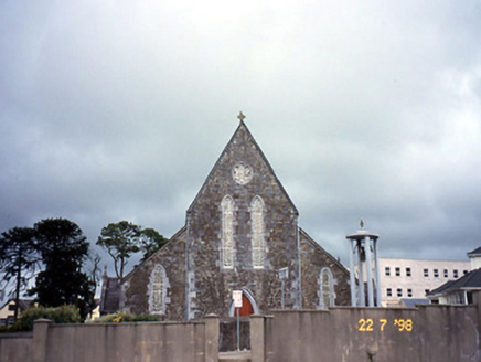 Saint Joseph's Catholic ChurchChurch/chapel · 2.7 mi
Explorer Tom Saint Joseph's Catholic Church in Rathmore got lost en route to a bigger parish and never checked its map. The Gothic details are sharp enough to cut through your bad decisions. Pack a picnic and an excuse.
 Caherbarnagh nw TopMountain / peak · 3.5 mi
 Rathmore Railway StationRailway station · 3.6 mi
Explorer Tom Rathmore Railway Station has a shortcut that leads you back to where you started. Opened in 1855, it has survived more renovations than most marriages. Bring a flask of something warm and a story to swap.
 Lissivigeen Stone CircleHeritage attraction · 8.5 mi
 Flesk CastleCastle · 9.0 mi
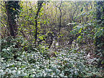 Sheheree Bog Nature ReserveNature reserve · 9.1 mi
 TooreencormickBattlefield · 9.6 mi
 Muckross AbbeyVisitor attraction · 9.8 mi
 European Yew9.8 mi
Explorer Tom Two families are feuding over this European Yew in County Kerry, purely because they can't agree on the view. It’s just a tree, but their pride is massive. Have a sandwich here and call it a heritage lunch.
 McCarthy Mor CastleCastle · 10.0 mi
More archaeology and monuments in County Kerry · All of County Kerry

What do you know about this place?Tap to add a comment or ask a question