
What is recorded here
In low-lying marginal land subject to flooding. This poorly preserved grassed-over circular mound (diam. 7.5m; H 1m) of earth and stone is revetted along the NE sector by six kerbstones and at W by a single kerbstone. It is overgrown with briars and thorn bushes at E. The mound contains a centrally placed drystone…
Read the whole record
From the National Monuments Service (Archaeological Survey of Ireland) record GA083-063
Places near here
Photo credits
- dougf, Geograph · CC BY-SA 2.0
- National Inventory of Architectural Heritage
- Andreas F. Borchert, Wikimedia Commons · CC BY-SA 4.0
- Stephan van Helden, Wikimedia Commons · CC BY-SA 4.0
- Graham Horn, Geograph · CC BY-SA 2.0
- Ingo Mehling, Wikimedia Commons · CC BY-SA 3.0
- Mac McCarron, Geograph · Creative Commons Attribution-ShareAlike 2.0
- Malene Thyssen, Wikimedia Commons · CC BY-SA 3.0
- DeeEmm, Wikimedia Commons · CC BY-SA 2.0
 Derrydonnell Castle (in ruins)Castle, tower house · 1473 yd
Explorer Tom Derrydonnell Castle was home to Tibbot Mac Davuck Burke. Six storeys of pure attitude. Best visited with a curious kid and no timetable to rush you around.
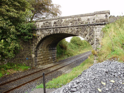 Derrydonnell BridgeBridge · 1.4 mi
Explorer Tom Derrydonnell Bridge has strict rules: no touching, no screaming, no dropping stones in the river. It’s still doing its job while you gawk at the limestone. Pick a stone, any stone, and invent a legend.
 Whistle BridgeBridge · 2.6 mi
Explorer Tom Whistle Bridge in Coldwood is keeping a secret scandal about a missing tractor from the sixties. It’s all limestone and concrete widening, looking very official while hiding a dirty little joke under its rough rubble coping stones. You’d better bring a flask to celebrate that hidden drama!
 Check mapCross, Market cross · 4.0 mi
Explorer Tom Check map in Athenry is actually a late fifteenth-century market cross in the town square. It’s been watching people haggle for centuries while pretending it doesn’t care about prices. Pretend it's yours and plan the housewarming party with local vendors.
 Horse-chestnut4.0 mi
 Athenry AbbeyHeritage attraction · 4.0 mi
 Athenry CastleHeritage attraction · 4.1 mi
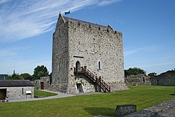 Castle or King Johns Court (in ruins)Castle, Anglo-Norman masonry castle · 4.1 mi
Explorer Tom Castle or King Johns Court in Athenry, County Galway was built by Meiler de Bermingham around 1235, but I suspect King John just used it for his afternoon tea. It controls a ford over the River Clareen. Bring the dog, it'll have opinions.
First Battle of AthenryBattle · 4.2 miExplorer Tom The First Battle of Athenry involved a cow that tried to buy its way out with milk. History is mostly made up by people who were hungry. Pick a stone, any stone, and invent its biography.
 Grave YardGraveyard · 5.3 mi
Explorer Tom Graveyard in Stradbally South sits on a slope overlooking the river, looking very serious about it. It gave up chocolate for Lent last year, so be gentle. Perfect place to be dramatically windswept.
 European Beech6.4 mi
 Knocktuagh alias Knockdoe ...Battlefield · 7.0 mi
More archaeology and monuments in County Galway · All of County Galway

What do you know about this place?Tap to add a comment or ask a question