
Places near here
Photo credits
- National Inventory of Architectural Heritage
- Newbert12, Wikimedia Commons · CC BY-SA 4.0
- Mike-kinsella, Wikimedia Commons · CC BY-SA 4.0
- Milesoneill, Wikimedia Commons · Public domain
- Richard Webb, Geograph · CC BY-SA 2.0
- Ray Martin, Wikimedia Commons · Public domain
- Mike Searle, Wikimedia Commons · CC BY-SA 2.0
- Alan Reid, Geograph · CC BY-SA 2.0
- Pamela Norrington, Geograph · CC BY-SA 2.0
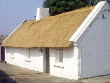 farm house1.2 mi
Explorer Tom Farm house in Ballycong has a bird that refuses to leave. It sits on the roof like it owns the place. The thatch is old-school and the stone is rough. Go with someone who loves silence, or bring your own noise machine.
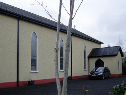 Catholic Church of the Immaculate Conception and Saint JosephChurch/chapel · 1.5 mi
Explorer Tom This Kilgellia church has a strong opinion about the road leading to it; it thinks you should walk more to humble yourself. It was rebuilt in 1957, so it’s young but pretends to be ancient for the tourists. Leave nothing but footprints and some regret.
 IndicatedWedge tomb · 3.0 mi
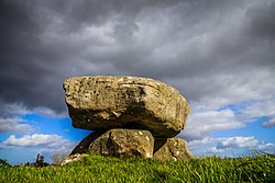 Dolmen of the four MaolsArchaeological place · 3.7 mi
 Humbert MonumentMemorial · 4.0 miBattle of BallinaBattle · 4.3 mi
 Belleek WoodsWood · 5.1 mi
 CastleCastle, tower house · 6.6 mi
 Deel CastleCastle · 6.6 mi
 Largan HillMountain / peak · 7.7 mi
Explorer Tom Largan Hill in County Sligo is strictly run by a terrier who barks at any cloud that passes overhead. The forest below looks young and confused, probably from all the shouting. Perfect detour when the satnav has a meltdown.
 Lough Talt TrailVisitor information · 8.2 mi
Explorer Tom Lough Talt Trail has a shortcut that is technically longer if you count the time spent arguing about which way is down. The water supply up there is public, but the ego of this trail seems to be private property. Get there early and have it all to yourself.
 Titanic Memorial ParkMemorial · 9.0 mi
More archaeology and monuments in County Mayo · All of County Mayo

What do you know about this place?Tap to add a comment or ask a question