
Places near here
Photo credits
- National Inventory of Architectural Heritage
- Ronnie Nijboer, Wikimedia Commons · CC0
- Willthacheerleader18, Wikimedia Commons · CC0
- Mike Searle, Wikimedia Commons · CC BY-SA 2.0
- Miguel Angel Masegosa Martínez, Wikimedia Commons · CC BY 2.0
- AmandaMcCrann, Wikimedia Commons · CC BY-SA 4.0
- Peter Allen, Wikimedia Commons · CC BY-SA 2.0
Explorer Tom Enclosure in Greenville was built on a bargain so good the other guys are still jealous, probably involving a trade of livestock for a really nice view of absolutely nothing. Now there’s no trace left at all, just a map marker and a hummock that looks like it fell asleep mid-storm. Go before the tourists find out.
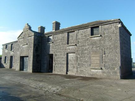 Greenville HouseStables · 228 yd
Explorer Tom Greenville House has an imaginary twin across the sea that it claims to talk to via the wind every night. The stonework is so fine it looks like it was carved by angels with bad eyesight. Find a local and ask them why.
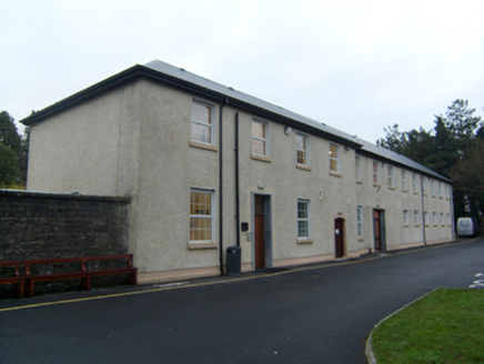 Saint Jarlath's SchoolWorkhouse · 1.3 mi
Explorer Tom Saint Jarlath's School workhouse in Bovinion would order extra vinegar with its chips because it remembers hunger. It housed five hundred inmates, so it’s seen worse than your attitude. It’s free, it’s odd, what more do you want from a building?
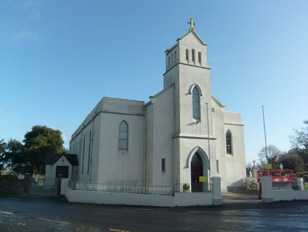 Saint Solan's Catholic ChurchChurch/chapel · 1.3 mi
Explorer Tom Saint Solan's in Caltra started because two lads made a bet in the pub about who could build it cheaper. It was extended in the thirties to handle the new crowd. Stand back, it’s got presence
 Wych Elm2.6 mi
Explorer Tom Wych Elm in County Galway was supposedly planted after a legendary bargain where a farmer traded his firstborn cow for shade. It’s still waiting for the interest to be paid out in hay bales, which is why it looks so grumpy. Pretend you're a lost aristocrat, nobody will check.
Ballinlass Eviction MemorialMemorial · 3.4 miExplorer Tom Ballinlass Eviction Memorial in County Galway has a secret talent for making people feel slightly guilty about their comfortable shoes. It’s a quiet stone with a loud heart and a heavy history. Bring a pen pal, they'll be jealous.
 Clonbrock CastleCastle, tower house · 4.2 mi
Explorer Tom Clonbrock Castle is well-preserved, partially restored, and sits in flat woodland by the river. Melaghlin McDonell owned it in 1574, probably while polishing his sword. Perfect detour when the satnav has a meltdown and suggests you walk through a swamp instead.
 Tower (in Ruins)Castle, tower house · 4.4 mi
Explorer Tom Tower in Castle Ffrench is standing there with its coat of arms, built in 1683 to show off a bit. It’s basically a brick letter that never got sent. Bring a pen pal, they'll be jealous of how well it's holding up over the years.
 Sweet Chestnut4.4 mi
Explorer Tom Sweet Chestnut in County Galway would make Saint Patrick laugh his socks off. He’d call it a bit of a show-off for the acorns. Visit, then text me what you think. I'll pretend to read it.
Menlough iraMemorial · 4.9 miExplorer Tom Menlough IRA would say in a job interview that it’s 'flexible' and 'good under pressure,' which is code for 'I’m broken.' It’s standing there with a story it’s not quite ready to tell anyone. Go on, count the windows and get it wrong like I did.
 Kellys MonumentMonumental structure · 7.6 mi
Explorer Tom Kellys Monument in Killeroran is a round tower that gave up its height for Lent and decided to lie down flat and take a nap forever. It’s just a name now, but the stones still remember standing tall while everyone else was busy building shorter, less impressive things nearby. Ideal for a moody photo you'll pretend wasn't posed.
 Kilconnell AbbeyVisitor attraction · 8.3 mi
Explorer Tom Kilconnell Abbey would take its lotto win and spend it all on a really fancy hat for one of the statues just to see if anyone notices. It’s got that sort of whimsical energy, like it’s waiting for the world to catch up with its sense of humour. Mind the nettles, they're the real guards here.
More archaeology and monuments in County Galway · All of County Galway

What do you know about this place?Tap to add a comment or ask a question