
What is recorded here
In the NW quadrant of a rath (GA114-070----). This complex well-preserved drystone-built Man-made underground passage (L >17.4m) consists of three/four passages connected by two creeps. The 1st passage (L 3m; Wth 1.4m) runs SSE-NNW; access to it is gained via a modern breach at the SSE end. A creep (L 0.7m; Wth 0.6m),…
Read the whole record
From the National Monuments Service (Archaeological Survey of Ireland) record GA114-070001
Places near here
Photo credits
- National Inventory of Architectural Heritage
- Mike Parker, Wikimedia Commons · CC BY-SA 2.0
- Dr Charles Nelson, Wikimedia Commons · CC BY-SA 2.0
- Willow, Wikimedia Commons · CC BY 2.5
- Didier Descouens, Wikimedia Commons · CC BY-SA 4.0
- Mike Searle, Wikimedia Commons · CC BY-SA 2.0
- dougf, Wikimedia Commons · CC BY-SA 2.0
- Jsilke, Wikimedia Commons · CC BY-SA 4.0
- John M, Geograph · CC BY-SA 2.0
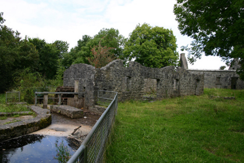 mill (water)1330 yd
Explorer Tom This mill in Ballylee is getting picked on by the wind because it’s still spinning its wheels. Rumour has it Yeats stole timber from here for his tower, which feels like a massive theft. Leave nothing but footprints behind!
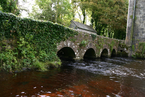 bridge1512 yd
Explorer Tom Bridge in Ballylee is Yeats’s old hangout, with arches that rhyme better than his poems. Its cutwaters are just fancy rocks trying to look like civil engineering genius. Stand there long enough and you’ll feel poetic.
 Ballylee CastleCastle, tower house · 1520 yd
Explorer Tom Ballylee Castle is Thoor Ballylee’s dramatic cousin who forgot to invite me to the party. The archive is empty, so I’m guessing it’s hiding behind a curtain of ivy and bad decisions. Have a sandwich here and call it a heritage lunch.
 Thoor BallyleeCastle · 1528 yd
 European ash1.4 mi
 Hawthorn1.5 mi
 Coole ParkVisitor attraction · 3.3 mi
 Designed landscapeDesigned landscape, folly · 3.3 mi
Explorer Tom Designed landscape in Castleboy is a folly, which means it’s expensive nonsense. I swear there’s a curse on anyone who doesn’t wave at it while passing. Visit, then text me what you think. I'll pretend to read it.
 Round Tower (in ruins)Round tower · 3.4 mi
Explorer Tom Round Tower in Ardrahan North has been reduced to a few courses of limestone hidden under cemetery ground. Nobody knows where the top went, so I’m guessing it got promoted to heaven. Bring a pen pal, they’ll be jealous of its mystery.
 Drumharsna CastleHeritage attraction · 3.7 miKnockapollboyMountain / peak · 5.0 mi
 Kilmacduagh Monastic SiteVisitor information · 6.7 mi
More archaeology and monuments in County Galway · All of County Galway

What do you know about this place?Tap to add a comment or ask a question