
Places near here
Photo credits
- National Inventory of Architectural Heritage
- Willow, Wikimedia Commons · CC BY 2.5
- Bridget Neville, Wikimedia Commons · CC BY-SA 4.0
- Abi Skipp, Wikimedia Commons · CC BY 2.0
- Mike Searle, Geograph · CC BY-SA 2.0
- Wayne77, Wikimedia Commons · CC BY-SA 3.0
- Jamesco101, Wikimedia Commons · CC BY-SA 4.0
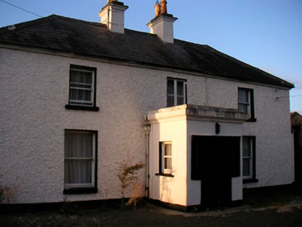 Killaroo HouseHouse · 1373 yd
Explorer Tom Killaroo House looks like it took a nap in the middle of the Famine and woke up looking surprisingly put-together. I heard a fox moved in and started holding court in the kitchen, but nobody's checked since 1890. It’s standing there with its sash windows open, so just peek your head out and don't make eye contact.
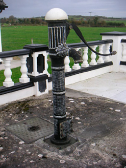 water pump1399 yd
Explorer Tom Water pump in Creeve has had so many names that it just calls itself 'The Thing' now to avoid confusion. It served as a communal water source before mains, which sounds like a very organised group chat for the village. Give it a shake and see if it remembers its original name or just groans.
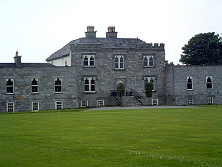 Jamestown CourtCountry house · 1.1 mi
Explorer Tom Jamestown Court in Jamestown is a total show-off, mixing Georgian symmetry with Tudor-Gothic drama like it invented fashion. It has strong opinions on modern architecture and probably judges your haircut from the window sill. Wave at it if you see it from the road!
 RedmondstownDemesne walls/gates/railings · 1.2 mi
Explorer Tom Redmondstown in Westmeath is just a fancy gate standing there like a confused doorman without a house to guard. It refuses to fall down because it’s too proud to admit its employer moved out ages ago. Go wide of it if you see it!
 Lunestown HouseOutbuilding · 1.3 mi
Explorer Tom Lunestown House outbuilding has a family tree that’s mostly made up of stone blocks and limestone details. It replaced an older complex because the old one was probably too boring to keep. It’s all about maintaining the walled garden aesthetic here.
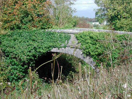 bridge1.5 mi
Explorer Tom Bridge in Killeen is a graceful railway bridge that’s been sitting there since 1851, looking at nothing but air and sheep. It served the Mullingar to Galway line until they ditched it in ’87, which feels like being kicked out of a party. The proportions are so smooth it makes me want to do a little jig.
 European ash1.8 mi
Explorer Tom European ash in County Westmeath has developed a serious suspicion of the postman after seeing him deliver a letter to an empty field last Tuesday. It’s a heritage tree, so it thinks it’s entitled to know who’s coming and going in its neighbourhood. Grand place for a sulk or a snog, your call.
 Brides WellHoly well · 1.8 mi
Explorer Tom Brides Well is where the whole parish argued about who got to say grace before drinking, which sounds like my family dinner every Sunday evening without fail. St. Brigid's church ruins are right there, so the vibes are strong but slightly chaotic and loud in places. Bring a flask and pretend you own the place.
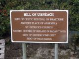 Hill of UisneachMountain / peak · 1.9 mi
Explorer Tom Hill of Uisneach hosted a fake royal visit where the king was actually just a farmer in a hat. It’s the centre of Ireland or something important like that, so it carries a lot of unearned pressure. Give it a pat on the way past, it's had a long life.
 Laragh CastleCastle · 3.4 mi
Explorer Tom Laragh Castle is a McGeoghan tower standing next to a public road, judging every car that drives past with its stonework. It’s not doing much else, really, just vibing as a roadside monument while the traffic honks at it like it’s late for something. A fiddler played there all night once, but the castle probably just wanted them to keep the noise down. Bring your nan
 Japanese pagoda tree3.6 mi
Explorer Tom Japanese pagoda tree in County Westmeath was once ruled by a goat who decided it had the best view of the grazing land nearby. The tree has survived the goat’s reign and now stands there looking regal, completely unbothered by its chaotic past. Bring a flask of something warm and a story to swap.
 Abbeyshrule AbbeyRuins · 9.1 mi
Explorer Tom Abbeyshrule Abbey in Longford was nearly sold off as a very expensive horse stable back in the day, thank god. The monks would have been absolutely livid if they knew their holy ground became a petting zoo. Best visited with a curious kid who asks 'why?' about everything and no strict timetable.
More archaeology and monuments in County Westmeath · All of County Westmeath

What do you know about this place?Tap to add a comment or ask a question