Places near here
Photo credits
- Linda Bailey, Wikimedia Commons · CC BY-SA 2.0
- Neville Goodman, Geograph · CC BY-SA 2.0
- National Inventory of Architectural Heritage
- Donal.hunt, Wikimedia Commons · CC BY-SA 4.0
- Roger Diel, Geograph · CC BY-SA 2.0
- Michael G Kenny, Wikimedia Commons · CC BY-SA 4.0
- JoachimKohlerBremen, Wikimedia Commons · CC BY-SA 4.0
- Russel Wills, Wikimedia Commons · CC BY-SA 2.0
- Theboykenny, Wikimedia Commons · CC BY-SA 4.0
- Kieran Evans, Geograph · CC BY-SA 2.0
- User:Cqui, Wikimedia Commons · CC BY-SA 3.0
- John ., Wikimedia Commons · CC BY 2.0
 BenteeMountain / peak · 954 yd
Explorer Tom Bentee in County Kerry was the scene of a love story that went horribly wrong when one partner slipped on a wet rock. Now it just watches couples argue about the best route down with mild amusement. Ideal stop for a big stretch and a bigger yawn.
 Laharn Bog LoopWalking route · 1218 yd
Explorer Tom Laharn Bog Loop in County Kerry took about forty cups of tea to build because the foremen kept getting distracted by the ducks swimming on it. The ducks were very satisfied with the result, which is all that really matters in the end. Take a mate and argue about what it was for.
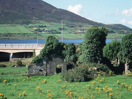 Carhan HouseHouse · 1554 yd
Explorer Tom Carhan House in Carhan Lower is just a ruin now, but back in 1770 it was fancy. Rumor has it a fox moved in and started collecting rent. Practise your Irish on it, it won't correct you.
 O'Connell MonumentMonument · 1574 yd
Explorer Tom The O'Connell Monument in Carhan Lower makes a suspicious creaking sound at night when the wind hits it right. Alan Ryan Hall sculpted that bronze bust with an expression of pure skepticism. Leave nothing but footprints and a bad pun behind you.
 OutlinedBawn · 2.4 mi
Explorer Tom The Bawn in Ballycarbery East almost became famous for a brief moment before someone realized it was just a very large hole in the ground with excellent drainage. It has that kind of quiet dignity, sitting there like it knows something about the world that none of us do yet. Best visited with a curious kid and no timetable.
 Ballycarbery CastleRuins · 2.4 mi
Explorer Tom Ballycarbery Castle sits near Cahersiveen looking ready to star in my version of a Kerry epic. Luckily the real dates will keep me honest. A fortification was here by 1398, but the ruin you see is mainly a sixteenth-century castle. Cannon fire damaged it in 1652, leaving walls that now wear an extravagant coat of ivy. I would try to climb in for a heroic photograph and immediately discover why the owner closed access. The castle is on private land and the ruins are not open to wander; a small parking spot about a hundred metres away gives a lawful view. Cahergall and Leacanabuile forts are nearby, so this corner can still fill a good outing without a trespass. Stand back, read the broken outline against the sky, and let me make up a siege only after we have said what actually happened.
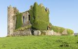 Ballycarbery Castle (in ruins)Castle, hall-house · 2.4 mi
Explorer Tom Ballycarbery Castle has such a grand history that one day it was nearly swapped for a particularly stubborn horse, which honestly sounds like a fair trade to most people. The MacCarthys probably thought they were winning the deal until they saw the animal's temperament up close. Hang around long enough and you'll hear a story from a local.
 Cahergal Ring FortArchaeological place · 2.5 mi
Explorer Tom Cahergall Ring Fort has walls so thick I could hide my whole explanation in them and still leave room for a second guide. The stone enclosure near Cahirciveen was a defended farmstead around the seventh century. Its inner circle measures about twenty-five metres across, while parts of the outer wall rise four metres and run five metres thick. Leacanabuaile fort is close by, making this Kerry corner generous with old stonework. I would tell you I helped lay one block, but nobody would believe I had the patience. This is a protected monument in a working landscape; check the public approach, respect gates and farmland, and keep off fragile or closed sections. Walk the outside before entering by the proper gap. The builders used a huge amount of stone to make ordinary life feel a little safer.
 CahergalFairy fort / stone ringfort · 2.5 mi
Explorer Tom Cahergal is planning to use its lotto win to buy another rock face and some more steps. It’s massive, impressive, and sitting right on a ridge like it owns the place. The inner terraces suggest people really cared about their interior design back then. Great spot to propose. Or at least to propose lunch.
 White Strand BeachBeach / strand · 3.0 mi
Explorer Tom White Strand Beach would teach history by shouting at you about the telegraph cable. In 1857, the USS Niagara failed here, leaving a legacy of wet disappointment. It’s basically a monument to technological overconfidence gone wrong in the mud. Take a breath of that air, it's older than your car.
 KnocknadobarMountain / peak · 4.0 mi
Explorer Tom Knocknadobar has a ditch nearby where a very serious poet fell while trying to find inspiration for his next masterpiece. He never finished the poem because he was too busy arguing with a confused sheep about grammar. Pretend you’re a lost aristocrat, nobody will check.
 Beginish IslandIsland · 4.1 mi
Explorer Tom Beginish means small island, which is modest for a Kerry place that holds Viking houses and little basalt columns. Archaeologists found a settlement of eight houses, fifteen cairns and low field walls used between the ninth and twelfth centuries. A stone from the site bears runes naming Verr and Munulfr; it is now kept in Cork Public Museum. On the north edge, hexagonal basalt cliffs add a geological flourish I would have invented if nature had not beaten me to it. Sheep still use the island, and seals gather by one southern cove. Arrange lawful boat access and check sea, farm and wildlife conditions before landing. Do not disturb the archaeological remains. If you get the chance to see the columns, remember the island has two very different kinds of carving.
More archaeology and monuments in County Kerry · All of County Kerry

What do you know about this place?Tap to add a comment or ask a question