What is recorded here
An inconspicuous opening on the mound's NE side, marked by a roofing lintel, leads into a Man-made underground passage passage (KE106-067001-), titled 'Cave' on the OS maps, that appears to extend to W. The passage is blocked by an accumulation of modern domestic debris. O'Sullivan and J. Sheehan (compilers), 'The Iveragh peninsula: an archaeological survey of South Kerry'. Cork University Press (1996), no. 715.
From the National Monuments Service (Archaeological Survey of Ireland) record KE106-067001
The monument record does not grant public access. Check the route and ask the landowner before entering private land.
- What survives
- Recorded monument
Places near here
Photo credits
- Nigel Cox, Geograph · CC BY-SA 2.0
- National Inventory of Architectural Heritage
- Eileen Henderson, Geograph · CC BY-SA 2.0
- DavidBosonnet, Wikimedia Commons · CC BY-SA 4.0
- Rossographer, Geograph · CC BY-SA 2.0
- Mike Searle, Geograph · Creative Commons Attribution-ShareAlike 2.0
- Matthew Chadwick, Geograph · CC BY-SA 2.0
- Mick Garratt, Geograph · CC BY-SA 2.0
- Dennis Turner, Wikimedia Commons · CC BY-SA 2.0
- Marathon, Geograph · CC BY-SA 2.0
- Sjunnesson, Wikimedia Commons · CC BY-SA 4.0
 CaherdanielFairy fort / stone ringfort · 387 yd
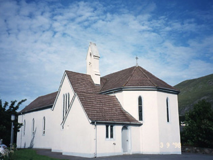 Saint Crohan's Catholic ChurchChurch/chapel · 518 yd
 Ogham StoneVisitor information · 1188 yd
 Teach Dhoire Fhíonáin [Derrynane House]Country house · 1.1 mi
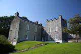 Derrynane House / Teach Dhoire FhionáinHeritage attraction · 1.1 mi
 Derrynane Beach / Trá Doire FhíonáinBeach / strand · 1.2 mi
 Burial GroundGraveyard · 1.7 mi
 Abbey IslandMountain / peak · 1.9 mi
 Abbey IslandIslet · 1.9 mi
 Lamb's IslandIslet · 1.9 mi
 Com An ChisteViewpoint · 2.6 mi
 Binn Uí RuaircMountain / peak · 2.8 mi
More archaeology and monuments in County Kerry · All of County Kerry
What do you know about this place?