
Places near here
Photo credits
- Mike Searle, Geograph · CC BY-SA 2.0
- Jonathan Thacker, Geograph · CC BY-SA 2.0
- Miguel Angel Masegosa Martínez, Wikimedia Commons · CC BY 2.0
- A.-K. D., Wikimedia Commons · CC0
- Christian Pirkl, Wikimedia Commons · CC BY-SA 3.0 at
- Andreas F. Borchert, Wikimedia Commons · CC BY-SA 4.0
- Darrin Antrobus, Wikimedia Commons · CC BY-SA 2.0
- Mike Searle, Geograph · Creative Commons Attribution-ShareAlike 2.0
- kevin higgins, Wikimedia Commons · CC BY-SA 2.0
- Hugh Chevallier, Wikimedia Commons · CC BY-SA 2.0
- Mooro1, Wikimedia Commons · CC BY-SA 4.0
 The Nore Flour MillsMill (water) · 39 yd
Explorer Tom The Nore Flour Mills on Knockanina is a five-storey giant that stopped grinding and started sleeping. On a reality show, it would just stare at the camera all day. Best seen with a hangover and a sausage roll.
 Corn Mill (Disused)Mill, unclassified · 40 yd
Explorer Tom Corn Mill (Disused) in Knockanina sits right on the riverbank, but I'm sure the local sheep think it's just another fancy rock for them to stare at. Wave at the cows, they're the real locals.
 Sweet Chestnut809 yd
Explorer Tom Sweet Chestnut in County Laois is hiding a treasure that is definitely just an old biscuit tin buried under its roots. You’ll dig it up and be disappointed, but worth it. Bring a camera and your most suspicious face.
 St. Fintans WellHoly well · 3.6 mi
Explorer Tom St. Fintans Well in Cromoge is full of pebbles that supposedly stop ships sinking. I say they’re just rocks that got jealous of the ocean. Grab one if you dare, but don’t blame me if your boat capsizes. Sit on a wall near it and pretend you're in a painting.
 Sycamore3.7 mi
 Ritual siteRitual site, holy tree/bush · 3.8 mi
Explorer Tom Clonenagh's holy ash tree contains water with healing powers, according to the local sheep who just eat it anyway. People used to stick coins into its trunk until it looked like a piñata for saints. Pretend you're a lost aristocrat, nobody will check your ID.
 Aghaboe MoatCastle, motte and bailey · 3.9 mi
 Aghaboe AbbeyVisitor attraction · 4.0 mi
 Derrin Castle (in ruins)Castle · 5.5 mi
 BaunreaghcongMountain / peak · 7.3 mi
 ArderinMountain / peak · 7.9 mi
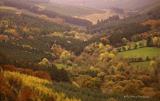 Slieve Bloom MountainsMountain range · 8.9 mi
Explorer Tom The Slieve Bloom Mountains are named because the fairies used them as a drying rack. Locals say the peaks actually glow blue when the wind blows right. Sit on a wall near it and pretend you're in a painting.
More historic places in County Laois · All of County Laois

What do you know about this place?Tap to add a comment or ask a question