What is recorded here
From the National Monuments Service (Archaeological Survey of Ireland) record DG055-018
Places near here
Picture notes
- Dr Neil Clifton, Wikimedia Commons · CC BY-SA 2.0
- National Inventory of Architectural Heritage
- Kenneth Allen, Wikimedia Commons · CC BY-SA 2.0
- Computer-made picture. It does not show this playground.
- 60McCurdy, Wikimedia Commons · CC BY-SA 3.0
- Kenneth Allen, Geograph · CC BY-SA 2.0
- Wikimedia Commons contributor · Public domain
- Ddoherty958, Wikimedia Commons · CC BY-SA 4.0
 Corn MillMill (water) · 839 yd
Explorer Tom Corn Mill in Haw (Killea) dates from around 1830 and keeps an external waterwheel on its gable wall. The record also describes a mill race to the south and remains of a kiln in an outbuilding. Even disused, this small cluster shows how grain and water once met.
 bridge857 yd
Explorer Tom Bridge in Haw is a c. 1800 single-arch giant straddling a tiny mill stream. It looks like it built that one massive stone smile specifically to intimidate a puddle.
 Rockfield Standing StoneStanding stone · 1.3 mi
Explorer Tom Rockfield Standing Stone is over two metres tall, but the picture says cows use it like a giant scratching post! I imagine them wiggling their noses against the rock to get a proper itch gone.
 Children's playground3.4 miComputer-made picture. It does not show this playground.
Explorer Tom I wonder if this sturdy Children's playground in County Donegal features a slide that makes a really loud whistle.
 Mongavlin CastleHouse, fortified house · 3.5 mi
Explorer Tom Mongavlin Castle is quite the sturdy survivor, with large walls and corner turrets still standing proudly from its days as a fortified house. Legend has it to be the home of Ineen dubh, mother of Red Hugh O'Donnell, so you’re stepping into some serious local lore here.
 Coyles barPub · 3.5 mi
Explorer Tom Coyles bar in County Donegal is probably hiding a secret stash of old pints behind the tap. I bet they serve a stout that tastes like it’s been marinating in peat for decades. Grab me a pint if you’re passing through!
 Battle of Binnion HillBattle · 3.5 mi
Explorer Tom After the 1557 Battle of Binnion Hill near Lifford, one captured horse stood out among the spoils: Shane O'Neill's horse, called 'The Son of the Eagle'. Even the horses had names fit for a clan chronicle.
 When Balor Came West: The Second Battle of Mag TuiredMythic battle remembrance · 4.7 mi
Explorer Tom When Balor Came West: The Second Battle of Mag Tuired sits on flat ground below Aileach, relying entirely on Eochu Ollathair’s poem rather than archaeology. I suppose it is easier to argue with a rhyme than a shovel.
 Burt CastleCastle, tower house · 4.7 mi
Explorer Tom Burt Castle's roofless keep still stands on the hill, with two round corner towers and rows of gun-loops. The old account even records a spiral stair with broken steps in the south-west tower. I would admire that stubborn stonework from safe ground; those steps sound like trouble.
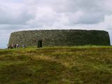 Grianán of AileachFairy fort / stone ringfort · 5.4 mi
Explorer Tom Grianán of Aileach has two roofed passages within its thick circular wall. Both curve toward the entrance and stop short. If you thought the fort was just one big ring of stone, the builders had another plan.
 Grianán of Aileach Outer HillfortHillfort · 5.4 mi
Explorer Tom Grianán of Aileach Outer Hillfort has a surprise outside the stone fort: three worn earthen rings may belong to a much older hillfort, perhaps from the Late Bronze or Iron Age. I came for one ancient place and found several piled into one hill! The long account below even traces an old road, a cairn and a holy well.
 Greenan MountainMountain / peak · 5.4 mi
Explorer Tom Greenan Mountain is a peak in County Donegal with no recorded access details. The picture looks north towards Inch Island, which makes me think the mountain is just using it as a background for its own very serious portrait.
More archaeology and monuments in County Donegal · All of County Donegal

What do you know about this place?Tap to add a comment or ask a question