
What is recorded here
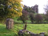
In 1618/19 Nicholas Pynnar recorded that near to the bawn of the house (DG079-023001-) of Sir John Kingsmill 'is built a Village consisting of 30 Houses, being all inhabited with English Families' (Hill 1877, 518). In 1631, Sir John Kingsmill was regranted the lands of Castlefinn which were created into the manor of…
Read the whole record
From the National Monuments Service (Archaeological Survey of Ireland) record DG079-046001
Places near here
Photo credits
- National Inventory of Architectural Heritage
- Kenneth Allen, Geograph · CC BY-SA 2.0
- Kenneth Allen, Wikimedia Commons · CC BY-SA 2.0
- Des Colhoun, Wikimedia Commons · CC BY-SA 2.0
- Mike Simms, Wikimedia Commons · CC BY-SA 2.0
- Rod Allday, Wikimedia Commons · CC BY-SA 2.0
 water pump6 yd
Explorer Tom Water pump in Castlefinn has a curved iron handle called a 'cow-tail'. Erected around 1885, it recalls the shared water sources towns used before pipes brought water to homes. That handle looks like a cow trying to flick away a fly, and I can't stop picturing the whole pump mooing.
 Red House Café/Stitched UpRic barracks, garda station/constabulary barracks · 41 yd
Explorer Tom RIC barracks in Castlefinn is showing off its moulded red brick eaves from the late nineteenth century. It’s got those tall chimneys that look like they’re trying to signal the next ship, so grab a photo of that brickwork for me!
 McBride’s BarPub · 207 yd
Explorer Tom McBride’s Bar is looking south at Sandy Road, which sounds like a beach but feels like a trap set by gulls. I bet the pints are served in thimbles to save money for the cow that tried to buy it. Mind the nettles, they're the real guards here.
 Magherareagh Standing StoneStanding stone · 1.3 mi
Explorer Tom Magherareagh Standing Stone is leaning so hard to the south-east it looks about to fall over! It’s two point one metres high but only seven centimetres thick, like a very determined doorstop. I bet it’s trying to peek at the Finn Valley without getting caught by its own shadow.
 Dooghan / Carnowen Standing StoneStanding stone · 1.8 mi
Explorer Tom Dooghan / Carnowen Standing Stone is a whopping 1.88m tall, which means it’s basically as big as me! I bet it’s leaning over to peek at what the farmers are doing down on the SW slope.
 Battlefield in Cloghfin (castlefin Ed)Battlefield · 1.8 mi
Explorer Tom Battlefield in Cloghfin is where history got its arse kicked and nobody kept receipts. The ground still smells like old grudges and wet sheep. Stand there long enough and someone will ask if you're lost, or just broke.
 Carnowen HillMountain / peak · 1.8 mi
Explorer Tom Carnowen Hill in County Donegal is the subject of constant seagull gossip, with them whispering about whether it’s peaked or just a big mound. They’re not sure either. Look serious, nod slowly, you're basically an expert now, don't overthink the bird chatter.
 Battle site: in 789 AD & battle of the fords , Southern crossing, 1689 in Clady; DonnygowanBattle site: in 789 AD & battle of the fords , Southern crossing, 1689 · 2.0 mi
 Croaghan HillMountain / peak · 2.8 mi
Explorer Tom Croaghan Hill keeps a 21-metre-wide passage tomb right in the middle of an enclosure where some walls are barely visible. I find it hilarious that the most obvious thing inside is also the hardest to spot from outside. It’s like hiding the key under the doormat, but the doormat has vanished.
 McCauley's RestaurantRestaurant · 4.9 mi
Explorer Tom McCauley's Restaurant on Bridge Street serves fish and chips swimming in suspiciously thick batter. The shortcut to the door isn't actually shorter, just windier. Stand still and listen, the wind tells it better than me.
 PalaceHouse, fortified house · 4.9 mi
Explorer Tom The Palace in Raphoe Demesne is a ghost with a very specific birth year of 1637. Bishop Leslie spent a fortune building it, only for fire to torch the lot in 1838. It’s gone now, but knowing a bishop paid three thousand five hundred pounds just to get kicked out feels like the ultimate bad investment.
 Let the Dance BeginSculpture · 5.2 mi
More archaeology and monuments in County Donegal · All of County Donegal

What do you know about this place?Tap to add a comment or ask a question