What is recorded here
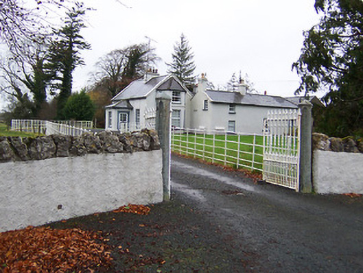
Joanstown Castle fell into ruin before the Down Survey measured Rathaspic parish, yet the Ledwich name still wrapped itself around hundreds of acres of Westmeath land. Ross O'Farrell's rebels took the stones in 1598, and Matthew and Richard Ledwich held the place through the storm of 1641. The exact spot has slipped from modern sight, but Joanstown House still stands near the Inny River where the old map marked the castle.
The precise location of the medieval castle of Joanstown depicted on the 1654-9 Down Survey map of Rathaspic parish (NLI, MS 723-4) has not been identified. This castle belonged to the Ledwich family. In October 1598 rebels belonging to Ross O'Farrell occupied the castle of Joanstown (Cal. S.P. Ire, 108). In 1628 Edward Ledwitch died possessed of the castle, vill and land of Ballinlacke & Grange containing 120 acres, Carrick 140 acres, 15 acres in Wollmorth, Keppagh 120 acres, 60 acres in Joanston, Conologh 30 acres and 30 acres in Heathland' (Walsh 1957, 127; Cal. inq. post mortem 42 Car. I.). In 1641 the castle and lands of 'Junnunstowne' [Joanstown] amounting to 456 acres of profitable land and 58 acres of bog belonged to Matthew and Richard Ledwich who are listed as 'Irish Papists' (ibid.). The terrier of the Down Survey parish map of Rathaspic stated that in this parish there were '2 Castles one at Rathaspick in repaire and another at Junanstowne Ruined' (ibid.). The Down Survey map indicates that the castle was located a short distance S of the parish boundary with Russagh and W of the Inny River. Joanstown House marked on the 1911 ed. OS 6-inch map is located in the general area where Joanstown Castle is marked on the Down Survey parish map of Rathaspic.
Compiled by: Frank Coyne & Caimin O'Brien
Date of upload: 1 February 2017
The castle in Joanstown was held by the Ledwich family during the late 16th century and is remembered primarily through its depiction on the 1654-9 Down Survey map, offering a rare historical reference to its existence in Rathaspic parish.
The monument record does not grant public access. Check the route and ask the landowner before entering private land.
- What survives
- Recorded monument
Places near here
 Ardglass Househouse · 352 yd
 Fairy Hallhouse · 698 yd
 OutlinedEnclosure · 1.4 mi
 Partially hachuredEnclosure · 1.4 mi
 CastleCastle, motte · 2.0 mi
 Carrick CastleCastle · 2.3 mi
 Horse-chestnutHorse-chestnut · 2.4 mi
 Baronstown ForestWood · 2.4 mi
 Edgeworthstown BypassMemorial · 6.2 mi
 Rock of CurryCliff · 9.6 mi
 Granard MotteMotte-and-bailey castle remains · 9.7 mi
 1798 Monumentmonument · 9.8 mi