What is recorded here
Oliver Walsh built Ballykilcavan House around 1639 on the exact spot where the medieval castle stood, burying the old walls under new floors. Robert Hartpole received the castle in 1576, but Walsh erased it from the landscape and claimed its land for his own family. The Tudor arch window head left behind in the garden is all that remains of the castle Hartpole owned.
Ballykilcavan House (LA014-099002-) possibly built on site of or in close proximity to the medieval castle of Ballykilcavan which was granted to Robert Hartpole in 1576. The house stands on a low rise of ground S of the Stradbally River. This location matches closely the area where the castle is depicted on the Cotton map of Laois-Offaly dating from c. 1563 (Hore 1863, f.p. 345). The head of a Tudor arch window (LA014-099001-) located in the back garden of Ballykilcavan House (LA014-099002-) is all that survives of the levelled medieval castle. The precise location of the castle has not been identified. The castle may have been located on the grounds of Ballykilcavan House. Alternatively the house may have been built on the site of the castle.
In 1576 Robert Hartpole of Carlow was granted the ‘manor of the Blackeforde (LA014-045----), a castle in Monyferricke (LA014-100----), Rathmadocke alias the Blackeforde, the lands of Moniferick, Rathmadock alias the Blackeforde, Kilteighan, Garrans, Kilgessin, Ballekilkavan, Dromlin alias Killiclery, Inche alias Ballicowley, and Bavon an old castle in Colvanacre (LA008-015----) alias Colbanahore [Coolbanagher], the lands of Colvanacre alias Colbanahore, Ballarighan, Killgenne, Ballenebeg, Shanebeg, Ballemolrone, and Ballenestraghe, the lands of Shrowle [Shrule] (LA032-012001-), Ballyhormer, Ballecollin, Rathduf, Garribriken, Aghatenan, and Cappescribedor, in the lordship of Slemarge, a ruinous castle and lands in Clonrere [Clonreher] (LA013-019----) alias Merickeston, lands in Cultwerin, Killclonhoberd, Ballekillkaraghe, Knockandiere, Rathnemanaghe, and lands of Killehide, Ballehide, Garrenoe, Ballinecard, Farrinduf, Rossemore, and Ballim’Kegane, in the lordship of Slemarge, the lands of Ballirahen, Rossenalgan, Garroughe, Dormoile, and Capoile, or Cappahoile, in the same lordship; the advowson of the rectory of S. Fenton [Fintan], of Clowenenaghe [Clonenagh] (LA017-003001-), diocese of Leighlen, all in Queen’s co.. To hold for ever, by the service of a fouth part of a knight’s fee; rent £26 1s. 2d., Maintaining six English horsemen’ (Nicholls 1994, 376). Around 1639 the lands and castle of Ballykilcavan were acquired by Oliver Walsh who commenced the building of a house (LA014-099002-) on the site of the medieval castle (pers. comm. David Walsh-Kemmis).
Compiled by: Caimin O’Brien
Date of upload: 11 November 2015
Built in the late 16th century, Castle Ballykilcavan was granted to Robert Hartpole in 1576 during the Tudor period of English expansion in Ireland. It is remembered as part of the colonial administrative network established in the region.
The monument record does not grant public access. Check the route and ask the landowner before entering private land.
- What survives
- Recorded monument
Places near here
 Black WalnutBlack Walnut · 395 yd
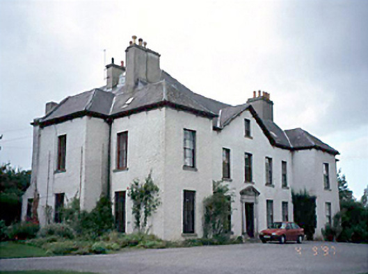 Ballykilcavan Househouse · 444 yd
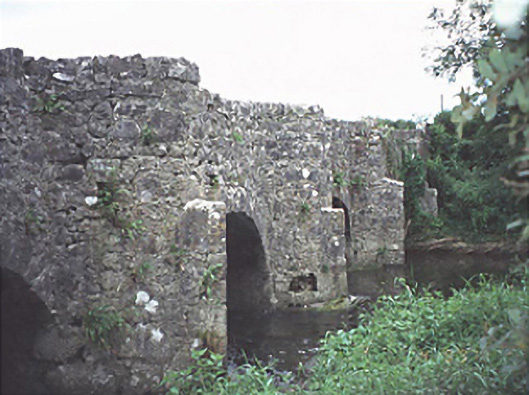 bridgebridge · 526 yd
 IndicatedEnclosure · 895 yd
 Enclosure in KnockphilipEnclosure · 1134 yd
 Ballyduff WoodWood · 1331 yd
 Beech Way WalkWalking route · 1.0 mi
 Blackford Castle (in Ruins)Castle, tower house · 1.0 mi
 Mass RockNamed rock · 1.1 mi
 CEMETERYGraveyard · 1.2 mi
 Oughaval Wood MapVisitor information · 1.2 mi
 Cobbler's Castle WalkWalking route · 1.2 mi