What is recorded here
Castle Scurlockstown stands as a square tower with two round stair turrets on a west-facing Boyne slope, recorded in 1640 with mills and cottages. It is not a distant myth but a working estate where stone, water and human labour met. The valley still holds its shape, and the castle remains the clearest marker of that forgotten local life.
Situated at the top of a W-facing slope in the valley of the River Boyne at a point c. 200m SE of where it turns from a NW-SE to a SSW-NNE direction. The motte (ME036-009----) is c. 160m to the NW and the parish church (ME036-010----) is c. 150m to the W. According to the Civil Survey (1654-6) Gerrott Leynes owned 268 acres in Scurlockstowne in 1640 and on the property were ‘a castle, two mills and some Cottages’ (Simington 1940, 139). The castle is described and illustrated by Wilde (1849, 104) as a square tower with two projecting circular towers which contained stairs. There are a few grass covered stone mounds on the site in 1967 (SMR file).
Archaeological testing (01E0316) in the environs c. 25m distant recovered no evidence of any attached features (Hayden 2003, 10), but investigation under the same licence c. 40m to the S and SW identified a stable (ME037-011001-) and other structures, while a kiln (ME037-011002-) and another building (ME037-011003) were recorded c. 80m and 100m SW of the tower house respectively. The remnants of a field system (ME0237-062----), which may have been associated with the settlement, survive c. 300m to the E. The excavated features are preserved beneath a white geotextile and a covering of topsoil. (Hayden 2001, 2003)
The above description is derived from the published 'Archaeological Inventory of County Meath' (Dublin: Stationery Office, 1987). In certain instances the entries have been revised and updated in the light of recent research.
Compiled by: Michael Moore
Date of revision: 13 July 2013
Amended: 21 August 2019
The monument record does not grant public access. Check the route and ask the landowner before entering private land.
- What survives
- Recorded monument
Places near here
 Scurlogstown CastleArchaeological place · 14 yd
 CastleCastle, motte · 160 yd
 Church (in Ruins)Church · 167 yd
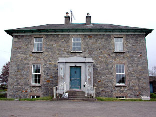 Newtown Parkhouse · 933 yd
 CrossCross, High cross (present location) · 1.2 mi
 Newtown AbbeyCathedral · 1.3 mi
 Small-leaved ElmSmall-leaved Elm · 2.7 mi
 Saints IslandForest · 2.9 mi
 MullaghMountain / peak · 7.8 mi
 Larchil Arcadian GardensHeritage attraction · 8.3 mi
 Kilgar GardensHeritage attraction · 8.3 mi
 Candle HillMountain / peak · 8.5 mi