What is recorded here
In low-lying terrain at base of gentle W facing slope, surrounded by pasture. Ringfort (TS076-022001-) located c. 90m to NW; possibly conjoined enclosures (TS076-022002- and TS076-022003-) located c. 80m to NE. Circular high, broad, flat-topped mound (diam. 33m N-S; 35.5m E-W; H 2.62-4.19m in NE and SW quadrants respectively) enclosed by a fosse (Wth 3.8m) and broad outer bank (Wth 1.8-6.3m crest, 4.5-10.6m in SW and NE quadrants respectively; H above int. fosse 1.23-1.7m in NE and SW quadrants respectively, H above ext. 1.09-1.4m in NE and SW quadrants respectively. In S sector the outer bank is augmented by a field boundary and has evidence of internal and external stone revetment. Interior slopes down towards E where entrance was probably located. Lush grass, thistles and nettles growing in interior with scrub mainly limited to edge of monument.
In low-lying terrain at base of gentle W facing slope, surrounded by pasture. Ringfort (TS076-022001-) located c. 90m to NW; possibly conjoined enclosures (TS076-022002- and TS076-022003-) located c. 80m to NE. Circular high, broad, flat-topped mound (diam. 33m N-S; 35.5m E-W; H 2.62-4.19m in NE and SW quadrants respectively) enclosed by a fosse (Wth 3.8m) and broad outer bank (Wth 1.8-6.3m crest, 4.5-10.6m in SW…
From the National Monuments Service (Archaeological Survey of Ireland) record TS076-022004
The monument record does not grant public access. Check the route and ask the landowner before entering private land.
- What survives
- Recorded monument
Places near here
Photo credits
- National Inventory of Architectural Heritage
- Mike Searle, Wikimedia Commons · CC BY-SA 2.0
- Sarah777, transferred by Lvova, Wikimedia Commons · Public domain
- Martin Richard Phelan, Geograph · CC BY-SA 2.0
- Andreas F. Borchert, Wikimedia Commons · CC BY-SA 4.0
- Chmouel Boudjnah Original uploader was Chmouel at fr.wikipedia, Wikimedia Commons · CC BY-SA 3.0
- Benutzer:StefanServos, Wikimedia Commons · CC BY-SA 3.0
- Algirdas at Lithuanian Wikipedia, Wikimedia Commons · Public domain
- Sitomon, Wikimedia Commons · CC BY-SA 2.0
- Deemaykay, Wikimedia Commons · CC BY-SA 4.0
- kevin higgins, Geograph · CC BY-SA 2.0
 Outrath LodgeRectory/glebe/vicarage/curate's house · 1089 yd
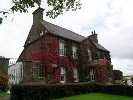 Keylong HouseHouse · 1.4 mi
 Knockgraffon CastleCastle · 2.2 mi
 Knockgraffon MotteArchaeological place · 2.4 mi
 Knockgraffon MoatCastle, motte and bailey · 2.4 mi
 Caher AbbeyHeritage attraction · 3.1 mi
 Siege of Cahir CastleSiege · 3.2 mi
 Cahir CastleCastle · 3.3 mi
 Pedunculate Oak4.0 mi
 European Yew4.2 mi
 CrossCross, High cross · 8.4 mi
 FarbreagaMountain / peak · 9.6 mi
More castles and forts in County Tipperary · All of County Tipperary
What do you know about this place?