Places near here
Photo credits
- National Inventory of Architectural Heritage
- MPF, Wikimedia Commons · CC BY 2.5
- A.-K. D., Wikimedia Commons · CC BY-SA 4.0
- kevin higgins, Geograph · CC BY-SA 2.0
- Humphrey Bolton, Geograph · CC BY-SA 2.0
- Colin Park, Geograph · CC BY-SA 2.0
- Willow, Wikimedia Commons · CC BY 2.5
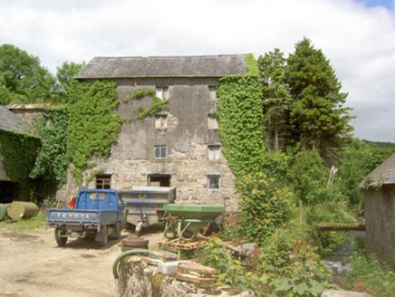 mill (water)1475 yd
Explorer Tom Mill in Ballynacloona is still grinding away at the idea that it’s better than the famous mill down the road, even…
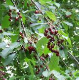 Wild Cherry1.0 mi
Explorer Tom Wild Cherry in County Tipperary has one bird that refuses to leave, even when it’s snowing or the owner is mowing right…
 Standing stone in BallinvirStanding stone · 1.5 mi
Explorer Tom Standing stone in Ballinvir is tall, tapering to a point, and was once worked on by a matchmaker who knew exactly which…
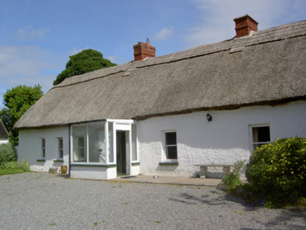 Ballynacloona CottageHouse · 1.5 mi
Explorer Tom Ballynacloona Cottage holds the unofficial world record for the longest thatched roof you can see without using…
 Templemichael Grave YardGraveyard · 1.7 mi
Explorer Tom Templemichael graveyard has a local who swears he invented the stile before it got blocked off by spiteful masonry.…
 Bawn in KilcashBawn · 1.9 mi
Explorer Tom Bawn in Kilcash had a poet fall into the ditch nearby trying to find inspiration, and now he claims he wrote his whole…
 Kilcash Castle (in ruins)Castle, tower house · 1.9 mi
Explorer Tom Kilcash Castle has a ghost that’s too lazy to haunt it properly, so he just sits in the corner reading newspapers and…
 SheegounaMountain / peak · 3.1 mi
Explorer Tom Sheegouna’s only New Year's resolution is to stop rolling its 'r' sounds so aggressively at passing sheep, which has…
 SlievenamonMountain / peak · 3.3 mi
Explorer Tom Slievenamon stands over south Tipperary like a mountain that knows it has been sung about. Its rounded summit carries…
 Knockroe Passage TombVisitor information · 3.8 mi
Explorer Tom Knockroe Passage Tomb has a long-standing grudge against the weather for ruining its lighting effects. It’s a…
 Killamery High CrossVisitor information · 4.5 mi
Explorer Tom Killamery High Cross has got a bird living up top that absolutely refuses to move out. It’s the most stubborn tenant in…
 European ash4.9 mi
Explorer Tom European ash in County Tipperary knows the shortcut through its branches isn't actually a shortcut at all, but rather a…
More castles and forts in County Tipperary · All of County Tipperary

What do you know about this place?Tap to add a comment or ask a question