What is recorded here
Castle, ringwork in Garrandee is an oval earthen enclosure in County Tipperary, Ireland, with a substantial bank, deep fosse, outer bank and gaps that suggest entrance and defence. It stands in pasture on a gentle slope, partly truncated by a field boundary, yet still shaped like a place where people moved, watched and belonged. Another possible ringwork lies nearby to the northwest, hinting that this was not a lonely mark but one voice in a smaller landscape of power.
In pasture, on a gentle N-facing slope. Remains of oval enclosure surviving as semi-circular area (dims . 22m N-S; 38m E-W) defined by substantial earthen bank (Wth 10.5m; int. H 1.1m; ext. H 3.2m). Gap (Wth 10m) in bank at W and gap (Wth 3.5m) at E. Monument truncated by field boundary (long-axis E-W) to N of gaps. Levelled remains of monument on N-side of field boundary defined by low rise W->N->NNE. Area of monument NNE-E possibly incorporated into field boundary. Deep intervening fosse (Wth 10.5m; D 0.7m) E-S-W. Possible causewayed entrance at SSE. Remains of outer bank (Wth 9m; int. H 1.1m; ext. H 0.4m) E-S-W is best preserved (Wth 7.4m; int. H 2.2m; ext. H 0.8m) SSW-WSW; gap (Wth 2.5m) in outer bank at E, breach at WSW and gap (Wth 4m) at W. Banks covered in briars and thorn trees, except SE-S. Interior has N-facing slope and is covered in tall grasses. Possible ringwork (TS068-104----) intervisible c. 235m to NW.
Compiled by: Jean Farrelly
Date of upload: 26 August 2011
The monument record does not grant public access. Check the route and ask the landowner before entering private land.
- What survives
- Recorded monument
Places near here
 LisheenEnclosure · 893 yd
 Ecclesiastical enclosure in MasterstownEcclesiastical enclosure · 1300 yd
 Bawn in GarranleaBawn · 1435 yd
 Garranlea Church (in ruins)Church · 1471 yd
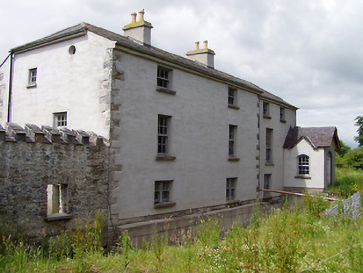 Mill Housemill (water) · 1.1 mi
 Knockgraffon CastleCastle · 1.6 mi
 Caucasian zelkovaCaucasian zelkova · 3.7 mi
 Athassel PrioryHeritage attraction · 3.9 mi
 Caher AbbeyHeritage attraction · 4.2 mi
 Cappa WoodWood · 4.4 mi
 Siege of Cahir Castlesiege · 4.4 mi
 Slieveanard NE TopMountain / peak · 4.7 mi