What is recorded here
Castle, motte in Granardkill is a circular dome-like mound at the east end of a north-south ridge, still marked by a berm, low bank and visible fosse. Uilliam O Ferghaill is named in connection with a castle built in 1405, though the exact identity of the site has been disputed. The mound sits above undulating countryside with panoramic views, suggesting a place chosen to be seen and to watch others.
At At the E end of a N-S ridge in undulating countryside with panoramic views in all directions. A circular dome-like mound (diam. c. 60m), that rises above a scarp (H 0.5-1.4m) from SSE-S-W, is encircled by a berm (Wth 6-7.5m; H 1.34-1.75m). The latter is enclosed by a low bank of earth and stone (Wth 6.45m; H 0.45m) from NNE-E-SSW and a low scarp (H 1.35-1.75m) from SSW-N-NNE. An intervening fosse (Wth 6.5-8.3m; D 0.85m) is visible from E-ESE, at SSE and from WNW-N and an outer bank is identifiable only at E. The original entrance appears to have been at NW where a causeway or slight ramp (Wth c. 3m) crosses the fosse. The classification of this monument is problematic. Bradley et al. (1985, 18) regarded it as a ringfort and suggested that the castle (LF010-08004-) built by Uilliam O Ferghaill (O'Farrell) in 1405 may have been located here rather than on the motte and bailey (LF010-080001-), c. 770m to the NE, in Granard. However, it appears to be some form of fortification, possibly an earth and timber castle that was refortified in the 15th century or it could be an interesting example of a 15th-century Gaelic earth and timber castle.
Compiled by: Patrick F. O'Donovan
Date of upload: 16 April 2012
The monument record does not grant public access. Check the route and ask the landowner before entering private land.
- What survives
- Recorded monument
Places near here
 St. Patricks WellHoly well · 292 yd
 Site of Old Town of GranardSettlement deserted, medieval · 311 yd
 Church in GranardkillChurch · 365 yd
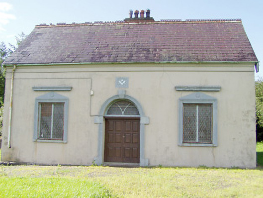 Granard Masonic Hallmasonic lodge/hall · 793 yd
 Moat of GranardCastle, motte and bailey · 887 yd
 CastleCastle, unclassified · 906 yd
 Granard MotteMotte-and-bailey castle remains · 925 yd
 1798 Monumentmonument · 1074 yd
 Clonfin Ambush MemorialMemorial · 3.1 mi
 Cloonfin WoodForest · 3.5 mi
 CartronfreeMountain / peak · 3.6 mi
 Derrycassan WoodsWood · 4.1 mi