What is recorded here
This is a Fallon castle, and Covaghe O'Failone of Milltown is listed in 1585 (O'Donovan 1843, 19) while Redmond O'Fallon had possession in 1587 (Cronin 1980, 118). A castle at Milltown is marked on the Strafford map of Athlone barony (c. 1636), and Redmond Mc Redmond Ffallon owned two quarters amounting to 500 acres there in 1641 but this land passed to Sir Luke Dowdall through the Cromwellian settlement (Simington 1949, 107, Athlone (170)). This monument might be Onagh castle which was built by the Justiciar in 1236 at Mullach Uanaidhe, although the ringwork at Dundonnell (RO051-047002-) is more probable. Onagh was attacked by Aedh O'Conchobair in 1270 but was probably still occupied in 1284. The castle is situated on a slight rise on the SE bank of the Ballyglass stream which here flows NE-SW in a canalised stream through low-lying basins to the NE and SW. The keep (int. dims c. 11m E-W; 8m N-S), of which the N wall (T 2.5m) is partly visible survives to a max. H of c. 6m but is obscured in a large cairn (diam. c. 40m; H up to 6m) which is within a wedge-shaped ward or bawn (RO047-058022-) (dims c. 75m N-S; c. 30m E-W at N; c. 70m E-W at S). The bawn is defined by a spread of stone and wall footings (Wth 0.75-1m) except at the N, and two towers can tentatively be identified, at the NW angle and at the centre of the S wall. An out-turned entrance and outer causeway (L 10m; Wth 3.5m) on the E wall leads to an outer wedge-shaped ward (dims c. 90m E-W; c. 80m N-S) which might not have been completed. The outer ward is defined by less substantial walls on the SE and NE sides backing onto the stream at W, and two rectangular towers can be identified, on the SE wall and at the E angle. There are four rectangular buildings within the inner bawn. Just S of the entrance causeway is a large rectangular structure (RO047-058023-) (int. dims c. 9m N-S; c. 6m N-S) with another structure immediately to its W (RO047-058024-) (int. dims c. 8m N-S; c. 3.3m E-W). About 10m further W is a smaller square building (RO047-058025-) (int. dims 4m x 3.5m) while a fourth building (RO047-058026-) (int. dims 10.2m NE-SW; 3.5m NW-SE) is inside the W wall of the bawn. The castle probably pre-dates the field system (RO047-058027-) which surrounds it, and three rectangular structures (int. dims c. 7m x c. 4m) are c. 80-100m to the E. See the attached aerial images taken from the NW (002) and SW (003).
This is a Fallon castle, and Covaghe O'Failone of Milltown is listed in 1585 (O'Donovan 1843, 19) while Redmond O'Fallon had possession in 1587 (Cronin 1980, 118). A castle at Milltown is marked on the Strafford map of Athlone barony (c. 1636), and Redmond Mc Redmond Ffallon owned two quarters amounting to 500 acres there in 1641 but this land passed to Sir Luke Dowdall through the Cromwellian settlement…
From the National Monuments Service (Archaeological Survey of Ireland) record RO047-058001
The monument record does not grant public access. Check the route and ask the landowner before entering private land.
- What survives
- Recorded monument
Places near here
CrossCross, Wayside cross · 874 yd Cam Church (in Ruins)Church · 2.4 miInchnagowerIslet · 2.6 miInchnaveague IslandIslet · 2.9 miSheep HillMountain / peak · 3.0 miwater pump3.5 miKellys MonumentMonumental structure · 6.6 miTower (in Ruins)Castle, tower house · 7.0 miCastle ffrenchCastle, unclassified · 7.1 miEuropean ash8.1 miSweet Chestnut8.6 miKilconnell AbbeyHeritage attraction · 12 mi
 Cam Church (in Ruins)Church · 2.4 miInchnagowerIslet · 2.6 miInchnaveague IslandIslet · 2.9 miSheep HillMountain / peak · 3.0 mi
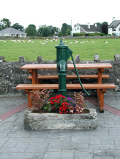 water pump3.5 mi
 Kellys MonumentMonumental structure · 6.6 mi
_-_geograph.org.uk_-_4071504.jpg/250px-Castles_of_Connacht,_Castle_Ffrench,_Galway_(1)_-_geograph.org.uk_-_4071504.jpg "Photo: Mike Searle, Wikimedia Commons · CC BY-SA 2.0") Tower (in Ruins)Castle, tower house · 7.0 mi
Tower (in Ruins)Castle, tower house · 7.0 mi Castle ffrenchCastle, unclassified · 7.1 mi
 European ash8.1 mi
 Sweet Chestnut8.6 mi
 Kilconnell AbbeyHeritage attraction · 12 mi
Pictures: Graham Horn, Geograph · CC BY-SA 2.0; National Inventory of Architectural Heritage; AmandaMcCrann, Wikimedia Commons · CC BY-SA 4.0; Mike Searle, Wikimedia Commons · CC BY-SA 2.0; Mike Searle, Geograph · CC BY-SA 2.0; Willow, Wikimedia Commons · CC BY 2.5; Miguel Angel Masegosa Martínez, Wikimedia Commons · CC BY 2.0; Andreas F. Borchert, Wikimedia Commons · CC BY-SA 4.0
More castles and forts in County Roscommon · All of County Roscommon
What do you know about this place?