What is recorded here
On a low NNE-SSW ridge in an undulating landscape, c. 170m S of Dysart church (RO047-060001-). Limestone cross facing NNW and SSE with a solid ring head (dims of shaft 0.3m x 0.24m; total H 1.75m), chamfered edges, an incised inscription commemorating Phelim and Sara O'Conor dated 1639, and a hand holding a hurley or club in relief on the NNW face. The shaft is set in a limestone block (dims 0.85m x 0.83m; H 0.35m) with chamfered edges which is set on a mortared limestone plinth (dims 1.4m x 1.4m) and which originally had three stages. (Siggins 1986b, 35)
See the attached view from the S
Compiled by: Michael Moore
Date of upload: 24 August 2010
On a low NNE-SSW ridge in an undulating landscape, c. 170m S of Dysart church (RO047-060001-). Limestone cross facing NNW and SSE with a solid ring head (dims of shaft 0.3m x 0.24m; total H 1.75m), chamfered edges, an incised inscription commemorating Phelim and Sara O'Conor dated 1639, and a hand holding a hurley or club in relief on the NNW face. The shaft is set in a limestone block (dims 0.85m x 0.83m; H…
From the National Monuments Service (Archaeological Survey of Ireland) record RO047-061
The monument record does not grant public access. Check the route and ask the landowner before entering private land.
- What survives
- Recorded monument
Places near here
Enclosure in Milltown (athlone South By.)Enclosure · 1299 yd Cam Church (in Ruins)Church · 1.9 miInchnagowerIslet · 2.3 miInchnaveague IslandIslet · 2.8 miSheep HillMountain / peak · 3.0 miwater pump3.8 miKellys MonumentMonumental structure · 6.8 miTower (in Ruins)Castle, tower house · 7.4 miCastle ffrenchCastle, unclassified · 7.5 miEuropean ash8.5 miSweet Chestnut9.1 miKilconnell AbbeyHeritage attraction · 13 mi
 Cam Church (in Ruins)Church · 1.9 miInchnagowerIslet · 2.3 miInchnaveague IslandIslet · 2.8 miSheep HillMountain / peak · 3.0 mi
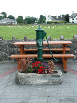 water pump3.8 mi
 Kellys MonumentMonumental structure · 6.8 mi
_-_geograph.org.uk_-_4071504.jpg/250px-Castles_of_Connacht,_Castle_Ffrench,_Galway_(1)_-_geograph.org.uk_-_4071504.jpg "Photo: Mike Searle, Wikimedia Commons · CC BY-SA 2.0") Tower (in Ruins)Castle, tower house · 7.4 mi
Tower (in Ruins)Castle, tower house · 7.4 mi Castle ffrenchCastle, unclassified · 7.5 mi
 European ash8.5 mi
 Sweet Chestnut9.1 mi
 Kilconnell AbbeyHeritage attraction · 13 mi
Pictures: Graham Horn, Geograph · CC BY-SA 2.0; National Inventory of Architectural Heritage; AmandaMcCrann, Wikimedia Commons · CC BY-SA 4.0; Mike Searle, Wikimedia Commons · CC BY-SA 2.0; Mike Searle, Geograph · CC BY-SA 2.0; Willow, Wikimedia Commons · CC BY 2.5; Miguel Angel Masegosa Martínez, Wikimedia Commons · CC BY 2.0; Andreas F. Borchert, Wikimedia Commons · CC BY-SA 4.0
More archaeology and monuments in County Roscommon · All of County Roscommon
What do you know about this place?