DDiscover AloneMapAbout

Castle in Kilbride

Castle, tower house

What is recorded here

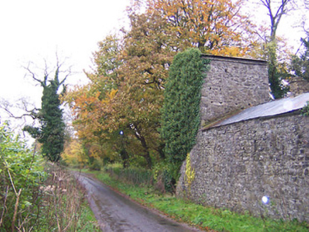
Kilbride Castle is depicted on the 1656 Down Survey parish map of Kilbride (NLI p.7384) where it is shown standing close to Kilbride Church (WM033-008---) on the lands of Richard Tyrell an Irish papist and owner of Kilbride Castle in 1641. The terrier of the Down Survey parish map states that in this townland stands…

Read the whole record
Kilbride Castle is depicted on the 1656 Down Survey parish map of Kilbride (NLI p.7384) where it is shown standing close to Kilbride Church (WM033-008---) on the lands of Richard Tyrell an Irish papist and owner of Kilbride Castle in 1641. The terrier of the Down Survey parish map states that in this townland stands 'a Castle and a Church (WM033-008----)' (NLI p7384). In 1663 an inquisition post mortem held at Mullingar on the 15th of March into the estate of the deceased Richard Tyrell listed 435 acres of land in Kilbride as part of his estate (Anon 1826, Car II (1)). The castle and lands of Kilbride then passed into the hands of the North family. Roger North of Kilbride Castle died in 1766. The castle was described in 1837 as 'Kilbride Castle, of A. J. Wilkington, Esq., where are the remains of a strong hold of the Tyrrells' (Lewis 1837, vol. 2, 56). Kilbride Church (WM033-0008---) is located 315m to the N. The monument was inspected in 1980 and described as a large rectangular castle (dims. 28.5m E-W; 13.5m N-S) aligned E-W with two angle towers surviving. The N wall of the castle no longer survives above ground except for a short section of the E end where it returns onto the NE angle. The E, S and W walls are still standing with the poorly preserved remains of a corner tower on the SW and NW angles. The remains of a garderobe can be seen in the SW angle tower. The remains of a base batter are visible along the upstanding sections of the castle walls however most of this batter has been robbed out. The ground floor possessed a stone vault the springing of which is visible at the E end of the S wall. According to the owner of the castle a wide entrance was inserted into the S wall in the 19th century. The remains of a mural stair can be seen in the S wall (T 3.5m) which gave access to the first floor level. The remains of a spiral stairs can be seen in the SW angle tower. The surviving windows consist of narrow slit opes set into wide deep embrasures. The castle is now covered with a galvanized roof and is used as a hayshed. A farmyard is located to the N of the castle, Kilbride House is 40m to the NE and a walled garden is located immediately to the W of the castle. The W end of Kilbride House contains a projecting rounded bay which appears to be the remains of a small tower possibly the NE angle tower of a bawn (WM033-010001-) that enclosed Kilbride Castle. Within this small angle tower are the remains of a spiral stairs. To the S of Kilbride House running alongside the road are the remains of a two storey dovecote incorporated into the 19th century walled courtyard of the house. Some pieces of cut limestone of medieval date can be seen in the farmyard to the N of the castle. A small kidney-shaped pond c. 20m to the SE of the castle is probably post-1770 in date with a small rockery on a platform to one side. It may be possible that this pond could represent the remains of an earlier medieval fish-pond associated with the nearby castle that was then converted into a landscape pond feature of Kilbride House. Alternatively this pond may be part of the 18th century landscaping of Kilbride House. The pond is c. 60m S of Kilbride House.

From the National Monuments Service (Archaeological Survey of Ireland) record WM033-010

The monument record does not grant public access. Check the route and ask the landowner before entering private land.

What do you know about this place?Tap to add a comment or ask a question

What you write will be public.

Places near here

Photo credits
  • National Inventory of Architectural Heritage
  • MookiePlays, Wikimedia Commons · CC BY-SA 4.0
  • Brian Shaw, Wikimedia Commons · CC BY-SA 2.0
  • kevin higgins, Wikimedia Commons · CC BY-SA 2.0
  • Dalenevada, Wikimedia Commons · CC BY-SA 4.0
  • EecherplazGinkgo06.jpg : Cayambe derivative work: Ginkgotree ( talk ), Wikimedia Commons · CC BY-SA 3.0
  • Willow, Wikimedia Commons · CC BY 2.5
Kilbride HouseStables · 23 yd

Explorer Tom Kilbride House stables thinks the road leading to it is a bad choice, mainly because it’s too smooth and lacks character for such a rugged complex. The dovecote is still trying to organize the pigeons into a proper formation, which is why they all look so confused when you pass by. If you hear cooing from the corner, wave; it’s just the stables saying hello

Dunboden ParkStables · 782 yd

Explorer Tom Dunboden Park stables are still suspicious of the postman, thinking he’s come to deliver another bad review. Those half-moon windows stare back like they’re judging your life choices. It’s basically a fancy barn with commitment issues.
water pump1540 yd

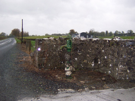
Explorer Tom Water pump in Gibbonstown has a ghost living inside it, but he’s too lazy to actually haunt anyone. He just sits there judging your hydration choices while pretending to be old-fashioned street furniture. Try not to look too thirsty when you pass by.

post box1740 yd

Explorer Tom Gibbonstown post box does yoga when nobody’s looking to keep its royal cipher flexible. It’s a George V era survivor that has seen more mail than your inbox. Tap it gently if you want to hear a tiny echo of the past.
Carrick HouseCountry house · 1.4 mi

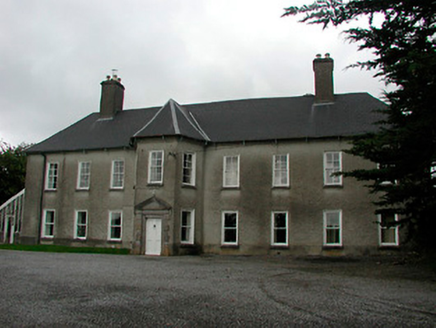
Explorer Tom Carrick House in Carrick is jealous of its neighbour Anneville House and keeps moving its canted projection around for attention. It thinks a fancy door bay makes it cooler than everyone else on the street, but it looks like it’s leaning over to whisper gossip. Tap the wall gently to see if it corrects your posture.

CastleCastle, unclassified · 1.7 mi

Explorer Tom Castlelost is stuck in a feud with its own motte over who owns the best view. Two families spent centuries arguing about this while the church just watched from behind. Hum something sad nearby, it adds atmosphere.

Tyrrellspass CastleCastle, tower house · 4.4 mi

Explorer Tom Tyrrellspass Castle makes a sound at night like a ghost clearing its throat before delivering bad news. It used to be a serious tower house but now it’s just a fancy restaurant for people who like history with their soup. Walk past slowly like you're in a film.
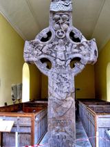
St. Columbkilles CrossCross, High cross · 11 mi

Explorer Tom St. Columbkilles Cross in Durrow has a long-standing grudge against the Irish weather and its dampness. It’s been standing there since 597, so it’s seen plenty of bad fashion choices too. Have a sandwich here and call it a heritage lunch.

Durrow High CrossVisitor attraction · 11 miCrossCross, High cross · 11 mi

Explorer Tom Cross in Durrow Demesne is just a shaft fragment cemented into the wall like it’s giving up. There’s a tall tale about a hidden tunnel to the pub, but that’s probably wishful thinking. Stick around for the light changing, it's a show.

Ginkgo11 mi

Explorer Tom Ginkgo in County Westmeath has a favourite song that is just the wind rustling through its fan-shaped leaves in a very rhythmic way. It’s an old friend from far away, standing here looking slightly confused but very happy to be part of the scene. Have a nosey, politely.

European ash13 mi

Explorer Tom This European ash in County Offaly is hiding a scandal about which branch grew first, and nobody agrees. It keeps the truth locked up tight while the leaves rustle with gossip. Go back in winter, it's a different animal when it’s all bare and honest.

More castles and forts in County Westmeath · All of County Westmeath

Add to this placeAdd a picture Add a detailed tip Add a story

Explore the map1,093,392 places to discover

Next place · or swipeKilbride House