What is recorded here
Castle (in ruins), Tracystown West stands on a low rise at the head of a slight SE-NW valley in County Wexford, Ireland. The rectangular tower house survives only to the top of the vault, its battered walls marked by granite quoins and a round headed entrance protected by a murder hole. William Hore owned the ruined castle and 360 acres in Trassestowne when the Civil Survey recorded the place in 1654-6. Mural stairs still rise toward a destroyed doorway, inviting wonder about the hands that climbed them before the vault fell silent.
References date only from the Civil Survey (1654-6) when William Hore is recorded as the owner of a ruined castle and 360 acres in Trassestowne as well as 300 acres in Ardenagh within Taghmon parish (Simington 1953, 84). It is located on a low rise and at the head of a slight SE-NW valley. The rectangular tower house (ext. dims. 7.85m E-W; 6.9m N-S) survives only to the top of the vault, and the NW angle is destroyed. The walls are battered and have granite quoins. A round headed entrance in undressed stone (Wth 0.96m; H 2.6m) is located towards the W end of the S wall. It is protected by a murder hole, and leads through a lobby into the ground floor (int. dims 4.8m E-W; 4.15m N-S), which originally had four embrasures with slit windows, of which only two survive. Mural stairs rise in the S and W walls to a destroyed doorway of the first floor under the E-W vault. This floor was supported on seven joists apparently set directly into the N and S walls. There area slight indications of earthworks to the S and E of the structure, perhaps the remains of a bawn (dims c. 50m N-S; c. 50m E-W).
The above description is derived from the published 'Archaeological Inventory of County Wexford' (Dublin: Stationery Office, 1996). In certain instances the entries have been revised and updated in the light of recent research.
Compiled by: Michael Moore
Date of upload/revision: 21 March, 2013
William Hore owned the ruined castle at Tracystown West in the mid-17th century, as recorded in the Civil Survey of 1654–56. Its significance lies in its mention alongside substantial landholdings, reflecting Hore's local influence during the post-Cromwellian land settlement in Ireland.
The monument record does not grant public access. Check the route and ask the landowner before entering private land.
- What survives
- Recorded monument
Places near here
 Castle (In Ruins)Ruins · 4 yd
 Bawn in Tracystown WestBawn · 22 yd
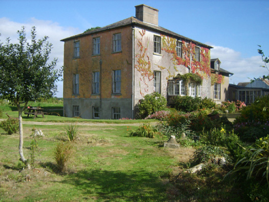 Hillburn Housefarm house · 648 yd
 Tottenham GreenHouse, 17th/18th century · 1189 yd
 TobershivaunHoly well · 1.1 mi
 Enclosure in Coolcull (moyler'sEnclosure · 1.4 mi
 Coolcliffe HouseRuins · 2.3 mi
 Camaross HillMountain / peak · 4.2 mi
 Carrickbyrne HillMountain / peak · 4.9 mi
 Glenour MonumentMemorial · 4.9 mi
 Carrig-On-BannowVisitor information · 5.9 mi
 1798 MemorialMemorial · 5.9 mi