Places near here
Photo credits
- Kenneth Allen, Geograph · CC BY-SA 2.0
- Ian Paterson, Wikimedia Commons · CC BY-SA 2.0
- Colin Park, Geograph · CC BY-SA 2.0
- Kmcnamee, Wikimedia Commons · CC BY-SA 4.0
- Rossographer, Geograph · CC BY-SA 2.0
- David Trochos at English Wikipedia, Wikimedia Commons · Public domain
- Kenneth Allen, Wikimedia Commons · CC BY-SA 2.0
- Colin Park, Wikimedia Commons · CC BY-SA 2.0
- Cormac Duffin, Geograph · CC BY-SA 2.0
 Aidan's WellSpring · 1459 yd
Explorer Tom Aidan's Well started because two lads bet in a pub that water would come from nowhere. They lost badly, but the well…
 Presbyterian ChurchChurch · 1520 yd
Explorer Tom Presbyterian Church in Margy Monaghan is hiding a ridiculous smuggling story about cheese being moved through the back…
 Binevenagh ViewViewpoint · 1.0 mi
Explorer Tom Binevenagh View sits high on the basalt shoulder above Magilligan, where County Derry suddenly seems to run out of land…
 St. Aidan's Park, St. Aidan's GAA, MagilliganGAA ground · 1.2 mi
 North Base Station, Lough Foyle Base LineMonument · 1.5 mi
Explorer Tom North Base Station, Lough Foyle Base Line in County Derry would explain the 1800s to a teenager by showing them a very…
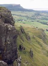 BinevenaghMountain / peak · 1.5 mi
Explorer Tom Binevenagh rises over the north coast like a cliff that decided to become a whole hill. The old lava country of the…
 Bellarena SchoolSchool · 1.6 mi
Explorer Tom Bellarena School in Bellerena is where they taught kids how to survive boredom before smartphones existed. The least…
 Swann's BridgePicnic place · 1.9 mi
Explorer Tom Swann's Bridge is off Seacoast Road and if it won the lotto, it’d probably buy a very expensive pair of wellingtons for…
 Manannán mac LirSculpture · 2.2 mi
Explorer Tom Manannán mac Lir sculpture in County Derry was probably built by a guy who was just trying to impress his girlfriend…
 Martello tower on magilligan point in Doaghs LowerMartello Tower on Magilligan Point · 4.2 mi
Explorer Tom Martello tower on magilligan point in Doaghs Lower is throwing a century-old tantrum. It claims to be a fortress but…
 Big Gortgole ForestForest · 24 mi
Explorer Tom Big Gortgole Forest took about ten thousand cups of tea to build, mostly by very thirsty forestry workers. The trees…
 Bracknamuckley ForestWood · 25 mi
Explorer Tom Bracknamuckley Forest handles nosey neighbours by simply growing a new tree right in front of their face, effectively…
More castles and forts in County Derry · All of County Derry

What do you know about this place?Tap to add a comment or ask a question