
What is recorded here
Downpatrick still stands at the edge of County Down, but the castle that once anchored the local demesne has vanished from every visible record. It may have fallen into the earth or been consumed by fields long before memory reached back far enough to name it. What remains is a hollow where a building should be, waiting for someone to stop asking whether it existed and start imagining the life it held.
The official Northern Ireland record identifies this as CASTLE. Recorded period: UNCERTAIN. The official map point was placed at the centre of the recorded archaeological site from the source map reference.
The monument record does not grant public access. Check the route and ask the landowner before entering private land.
- What survives
- Recorded monument
Places near here
 Holy Trinity CathedralChurch · 737 yd
 St. Patrick's GraveHeritage attraction · 738 yd
 DOWNPATRICK TOWN CROSS; BENEDICTINE MONASTERY; MULTIPERIOD CHURCH SITE; PRE-HISTORIC SETTLEMENT SITE; EARTHWORKS & GRAVEYARD: CATHEDRAL HILL in Demesne OF Down; DownpatrickDOWNPATRICK TOWN CROSS; BENEDICTINE MONASTERY; MULTIPERIOD CHURCH SITE; PRE-HISTORIC SETTLEMENT SITE; EARTHWORKS & GRAVEYARD: CATHEDRAL HILL · 768 yd
 Down County MuseumMuseum · 837 yd
 Cell BlockPrison · 846 yd
 The Mound of DownVisitor information · 892 yd
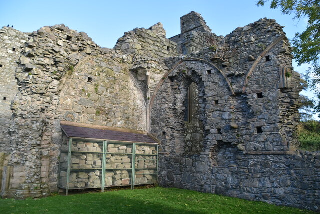 Inch AbbeyArchaeological place · 958 yd
 CHURCH & CASTLE (remains of): ST. MARGARET'S in Demesne OF Down; DownpatrickCHURCH & CASTLE (remains of): ST. MARGARET'S · 1127 yd
 TOWER-HOUSE: CASTLE DORRAS; CASTLE DERRAS in Demesne OF Down; DownpatrickTOWER-HOUSE: CASTLE DORRAS; CASTLE DERRAS · 1141 yd
 St Margaret's Down Parish ChurchVisitor information · 1154 yd
 Hollymount ForestWood · 1.1 mi
 Southwell Charity School And AlmshousesSchool · 862 yd
Other information
Photo: Credit not shown in the picture search · Rights wording not checked; contact us if this picture should be removed