
What is recorded here
Castle Ballyclare stands as a broken rectangular tower in low pasture, its thick limestone walls still rising three storeys beside a stream. In 1621 Connell McMurogh O’Feroll received the castle, lands and water-mill, tying stone, field and mill into one working grant. The surviving doorway and inner alcove suggest a household that moved through water, fire and guard rather than display. What is lost has not vanished; it has retreated behind the wall, waiting for someone to remember the shape of the room.
In low-lying pasture overlooking a stream from SSE–S–NW. In 1621 Connell McMurogh O’Feroll received a land grant including the ‘castle and lands of Bealalcare and a water-mill’ (LF018-102----) (Cal. pat. rolls Ire., Jas I, 533). The castle is depicted on an early 17th-century map of Moydow barony (BL, Cotton MS Augustus I.ii.28). It is a rectangular tower house (ext. dims. c. 9.5m NW–SE; 7.4m NE–SW; wall T 1.85m) constructed of roughly coursed limestone rubble. As a result of collapse, only sections of the NW and NE walls survive to a height of three storeys. Few architectural features are evident but the lower section of the NW jamb of a doorway is visible close to the S end of the NW wall. Immediately inside it, to the N, there is a large rectangular alcove. At first floor-level, in the NE wall, there is a simple rectangular ope.
Compiled by: Patrick F. O'Donovan
Date of upload: 1 June 2012
Connell McMurogh O’Feroll received a land grant in 1621 that included the castle and lands of Ballyclare, indicating English plantation activity in the area. The site is remembered as part of the broader 17th-century colonization of Ireland under James I.
The monument record does not grant public access. Check the route and ask the landowner before entering private land.
- What survives
- Recorded monument
Places near here
 Enclosure in AghantrahEnclosure · 648 yd
 Aghnaskea Bridgebridge · 670 yd
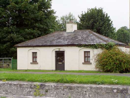 43rd Locklock keeper's house · 685 yd
 Enclosure in SharvogeEnclosure · 993 yd
 Graveyard in Curry (ardagh By., Coolamber Ed)Graveyard · 1.5 mi
 First World War MemorialMemorial · 3.7 mi
 Saint Mel's CathedralCathedral · 3.9 mi
 Bawn in AbbeycartronBawn · 3.9 mi
 Commons North WalkVisitor information · 5.5 mi
 Wild birdsVisitor information · 5.6 mi
 White Sand WoodWood · 5.8 mi
 Ballyclare IslandIslet · 6.1 mi
Other information
Photo: FUSIO · Licence wording not shown