What is recorded here
Castle Ballyboy East stands as a ruined hall-house on a natural rise above the River Tar, its thick limestone walls bearing solid semi-circular turrets at the northern angles. Sir Richard Everard and Catherine Tobin occupied this thatched castle near Clogheen during the 1630s before departing for Burncourt, leaving behind a structure where two later stone vaults now collapse among earlier wooden floor corbels. The southern face has been quarried away, yet the northern wall still holds three carved supports and a broken central opening that hints at the domestic life once sustained within its rough courses.
The Civil Survey (1654-6) refers to this as 'a castle covered with thatch without repaire' (Simington 1931, vol. 1, 372). In the first half of the 17th century Ballyboy was occupied by Sir Richard Everard and his wife Catherine Tobin who married in 1627. According to Everard (1907, 74-5), based on the wills of Edmund and Nicholas Everard, 1631 and 1633, they lived 'in the castle at Ballyboy, near Clogheen....Sir Richard was living in the castle at Ballyboy when (in 1639) he obtained a grant creating 'The Manor of Everard's Castle'. Richard and Catherine left Ballyboy c. 1641 to take up residence in their new mansion at Burncourt. It is unclear whether the Ballyboy residence refers to the castle, now in ruins, or the thatched house with bawn (TS087-024002-) mentioned in the Civil Survey (ibid.). Situated on a natural rise, the land falls steeply to the S towards the River Tar. The S side of the hall-house has been quarried away. It is constructed of large, roughly cut blocks of limestone, roughly coursed, with an external base-batter (H 0.65m; W 0.2m). Only the N wall (ext. dims. 14m; wall T 1.5m; H c. 4m) and portion of the E (L 0.8m) and W (L 1.85m) walls survive. The NE and NW angles have an external solid semi-circular turret, not apparent in the interior which is squared in plan. There is a large opening roughly centrally placed at ground-floor level in the N wall; this has been partially broken through. On the W half of the N wall in the interior there are three corbels at first-floor level to carry the floor. At a later stage two stone vaults were inserted; both rest on an inserted central pier positioned immediately S of the broken through opening mentioned above. The E vault, which has largely collapsed, springs from the E wall of the building. The W vault, also largely collapsed, appears to have abutted the W wall of the building. The vault is partially resting on the earlier corbels. The W wall now terminates at the N side of a splayed embrasure, probably of a window. There is a collapsed embrasure visible at first-floor level in the N wall.
Compiled by: Jean Farrelly
Date of upload: 25 November 2013
Ballyboy East Castle was occupied by Sir Richard Everard in the first half of the 17th century and was noted in the Civil Survey of 1654–55 as a thatched, unrepaired castle. Its mention in the Civil Survey highlights its status as a documented but likely modest stronghold during the turbulent period of Confederate Ireland.
The monument record does not grant public access. Check the route and ask the landowner before entering private land.
- What survives
- Recorded monument
Places near here
 Bawn in Ballyboy EastBawn · 43 yd
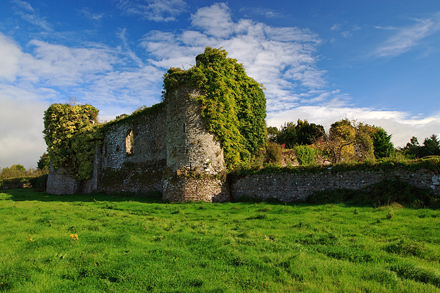 Castle Grace (in ruins)Castle, Anglo-Norman masonry castle · 1026 yd
 Enclosure in Ballyboy EastEnclosure · 1184 yd
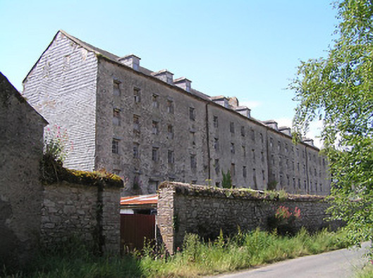 Castlegrace Millmill (water) · 1250 yd
 Castlegrace Housemill manager's house · 1256 yd
 Enclosure in CastlegraceEnclosure · 1757 yd
 Bohernagore WoodForest · 1.4 mi
 The VeeViewpoint · 2.0 mi
 Grubb’s GraveMemorial · 2.1 mi
 KnocknaloughaMountain / peak · 2.7 mi
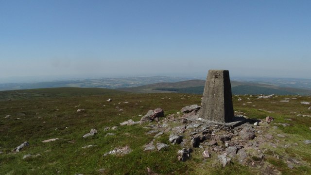 KnockshanahullionMountain / peak · 2.8 mi
 Sweet ChestnutSweet Chestnut · 3.1 mi