
What is recorded here
Castle Athleague is a three-storey fortified house with corner towers, built before 1640 for the earl of Clanrickard on the site of an older O'Kelly castle beside the River Suck. Its mill-race still ghosts through the garden as a shallow grassy ditch that floods in winter, marking the boundary of a place where water, stone and ownership kept turning around one another.
On the E bank of a NE-SW section of the River Suck, at a point where the river turns W. An O'Kelly castle (RO041-048001-) at Athliag Maenagan in Hy Many with references from 1487 was destroyed by 1595 (Cronin 1980, 110,117). In 1640 Athleague was owned by the earl of Clanrickard, and one of the earls probably built the fortified house before then on the site of the castle together with the two mills (RO041-048003-; RO041-048004-) recorded there in the 1640s (Simington 1949, 103). The Strafford map of c. 1636 shows the house on an island formed by the mill-race with a number of houses (RO041-048011-) while a church (RO041-048007-) is marked on the W bank of the river (ibid. Athlone map).
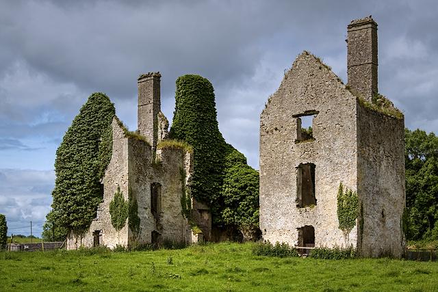
This is a rectangular three storey structure with an attic (int. dims 15.3m N-S; 6.1m E-W), of which just the N and S gables survives complete. There are fireplaces in the gables at each floor. Rectangular towers of three storeys and attic (int. dims 5.4m N-S; 5.1m E-W) are attached to the NE and SE angles with gables on the E and W walls, fireplaces on the W walls and windows on the other walls. The house is within a walled garden (RO041-048014-) (dims c. 100m N-S; c. 90m N-S) surrounded by a mill-race (RO041-048013-) which is evident as a grass-covered depression (Wth 8-10m; D 0.1-0.3m) that floods in winter, and connects with the River Suck above and below the house. There are fragments of old field banks (RO041-048010-) (Wth c. 2m; H 0.2-0.4m) covering c. 8 ha to the N and E of the house, including an E-W roadway (RO041-049009-) (Wth 6.5m; L c. 100m) defined by earthen banks and outer ditches.
See the attached view taken from the SE
Compiled by: Michael Moore
Date of upload: 24 August 2010
The castle at Athleague was built by the O'Kellys, a Gaelic Irish family, and is documented from 1487. It was strategically located on the River Suck and was destroyed by 1595, likely during the conflicts of the Nine Years' War.
This remains an important historical record, but the official description says the monument is no longer visible or has been destroyed. The monument record does not grant public access. Check the route and ask the landowner before entering private land.
- What survives
- No visible remains or recorded as destroyed
Places near here
 mill (water)mill (water) · 69 yd
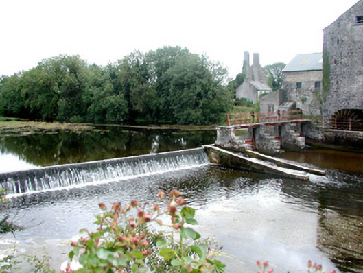 sluice/sluice gatesluice/sluice gate · 82 yd
 IndicatedFairy fort / earthen ringfort · 1253 yd
 Stone CrossCross, Wayside cross · 1.1 mi
 European Crab AppleEuropean Crab Apple · 1.1 mi
 Sally IslandIslet · 2.7 mi
 Castle KellyCastle, tower house · 3.4 mi
 European YewEuropean Yew · 3.5 mi
 Site of Ballygar CastleArchaeological place · 4.6 mi
 Roscommon CastleCastle · 5.3 mi
 Mount MaryMountain / peak · 5.4 mi
 Inch IslandIsland · 7.7 mi
Other information
Photo: Credit not shown · Copyright shown; no reuse licence shown