What is recorded here
In rough pasture, located on a low hillock. A road skirts the NW side of the hillock.
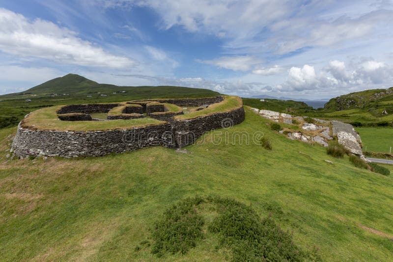
This cashel is named ‘Cashelgal Fort’ on the 1838 and 1919 OS 6-inch map. Slightly raised, circular area (31m NE-SW; c. 32m NW–SE) defined by the remains of a drystone wall.
The wall (Wth c. 3m) is low, dilapidated and largely sod-covered. The external wall face retains its basal two to three courses (max. H 0.8m), consisting of large stone blocks, but has collapsed above this level. The internal wall face (H 0.1m) is almost entirely collapsed or robbed, reduced to a low, sod-covered spread of loose stone, almost flush with interior ground level, with inner edge marked by a low, discontinuous line of sod-covered stones; at NNE–E it has a raised, sod-covered stony rim. A later field wall, on a NE–SW axis, crosses the E–SE edge of the cashel, overlying the inner wall face.
There is a berm-like stony embankment or scarp (max. Wth 3.5m) outside the wall at SSW–NW. At the SW a small, semi-circular area (Wth 2m) has been quarried out of this scarp.
The entrance may have been at the ENE where there is a gap (Wth c. 2m) in the enclosing wall, now partly obscured by the overlying field wall.
Much of the E half of the level interior is engulfed in blackthorn, and hazel trees grow around the perimeter. There is a ringfort (MA073-019----) c. 300m to NE.
Compiled by: Jane O’Shaughnessy
Date of upload: 4 June 2021
The monument record does not grant public access. Check the route and ask the landowner before entering private land.
- What survives
- Recorded monument
Places near here
 Cross (Remains of)Cross · 715 yd
 CashelFairy fort / stone ringfort · 792 yd
 farm housefarm house · 1033 yd
 Catholic Church of the Immaculate Conceptionchurch/chapel · 1160 yd
 Crunaun Castle (in ruins)Castle, unclassified · 2.5 mi
 Casatle (ruins)Castle, unclassified · 3.0 mi
 Bockagh HillMountain / peak · 4.4 mi
 East Mayo Brigade MonumentMemorial · 7.6 mi
 Bawn IslandIslet · 9.6 mi
 Rose PointHeadland · 10 mi
 Crow IslandIslet · 10 mi
 Coolougher WoodForest · 10 mi
Other information
Photo: Credit not shown in the picture search · Rights wording not checked; contact us if this picture should be removed