What is recorded here
Places near here
Photo credits
- Charles W Glynn, Wikimedia Commons · CC BY-SA 2.0
- Gordon Hatton, Geograph · CC BY-SA 2.0
- Richard cattel, Geograph · CC BY-SA 2.0
- The Banner, Wikimedia Commons · CC BY-SA 3.0
- Roger Diel, Geograph · CC BY-SA 2.0
- Simon Huguet, Wikimedia Commons · CC BY-SA 2.0
- Chris, Geograph · CC BY-SA 2.0
- National Inventory of Architectural Heritage
- GenesisNZ, Wikimedia Commons · CC BY-SA 4.0
- Charles W Glynn, Geograph · CC BY-SA 2.0
 Mutton IslandIsland · 1.0 mi
Explorer Tom Mutton Island! A small island with a name that sounds like it could be part of a royal lineage, what secrets does it keep in County Clare?
 Lurga PointHeadland · 1.3 mi
Explorer Tom Lurga Point stretches boldly toward Mutton Island, where the rocky reef meets the ocean in a splashy, wild embrace.
 Seafield North BeachBeach / strand · 1.5 mi
Explorer Tom Seafield North Beach gives views of Seafield harbour and Mutton Island in the distance, perfect for a wander.
 Catholic Church of Our Lady Star of the SeaChurch/chapel · 2.1 mi
Explorer Tom Quilty’s Star of the Sea church houses the bell from the French vessel Leon XIII, commemorating the 1907 wreck and rescue of its crew.
 Tromra CastleCastle, tower house · 2.2 mi
Explorer Tom Tromra Castle stands proudly on level marshy ground, keeping a close, curious eye on the distant Mutton Island to the northwest.
 Emlagh PointHeadland · 2.2 mi
Explorer Tom Emlagh Point is a headland in County Clare, perhaps offering a panoramic view of the bay and the western coastline ahead.
 Caherrush Castle (in Ruins)Castle, tower house · 2.4 mi
Explorer Tom Caherrush Castle sits quietly near Spanish Point, and you must check with the landowner before stepping onto this private tower house.
 Spanish PointHeadland · 3.0 mi
Explorer Tom Spanish Point’s cliff-edge walk near County Clare promises dramatic views, though access details remain a delightful local mystery.
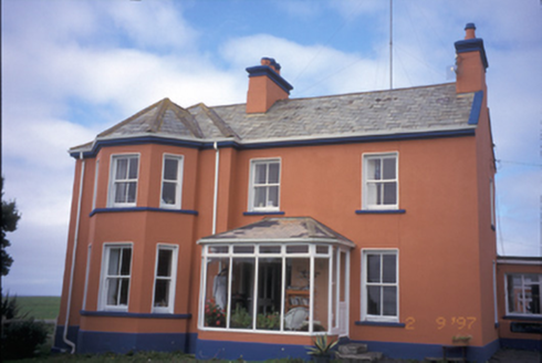 Atlantic LodgeCoastguard station · 3.1 mi
Explorer Tom Imagine Atlantic Lodge watching the sea from Breaffy South, its canted bay window a curious eye on the waves.
 Spanish Point BeachBeach / strand · 3.3 mi
Explorer Tom Spanish Point Beach is an extensive sandy stretch west of Milltown Malbay, though you’ll need to watch the bye-laws.
 Freagh IslandIslet · 4.6 mi
Explorer Tom Freagh Island, you're a tiny gem that only shows up at low tide. I bet the waves are always trying to stop you.
 Doughmore BeachBeach / strand · 4.6 mi
Explorer Tom Doughmore Beach offers great surf but shifting sands, so keep an eye out if you’re brave enough to paddle.
More islands in County Clare · All of County Clare

What do you know about this place?Tap to add a comment or ask a question