
What is recorded here
From OpenStreetMap (© OpenStreetMap contributors) n9003281043
Places near here
Photo credits
- Maker not stated on source page, www.dreamstime.com
- Kenneth Allen, Wikimedia Commons · CC BY-SA 2.0
- Maker not stated on source page, www.gu.se
- Maker not stated on source page, walkiees.co.uk
- Maker not stated on source page, www.flickr.com
- Maker not stated on source page, monumentalireland.ie
- Colin Park, Geograph · CC BY-SA 2.0
- Maker not stated on source page, www.msn.com
- Maker not stated on source page, www.pinterest.com
- C Michael Hogan, Wikimedia Commons · CC BY-SA 2.0
- Kenneth Allen, Geograph · CC BY-SA 2.0
 Cairn: killoran or giant's grave in CarrowaghtraghCairn: Killoran or Giant's Grave · 1.5 mi
Explorer Tom Cairn: Killoran or Giant's Grave in Carrowaghtragh is sick of being asked about the giant. He was probably just a big…
 Goles Stone RowArchaeological place · 1.7 mi
Explorer Tom Goles Stone Row would say in a job interview that it has excellent alignment skills and can observe the rising moon…
 Stone alignment in GolesStone Alignment · 1.7 mi
Explorer Tom Goles’ stone alignment is lined up like a queue for a bus that hasn’t run in three thousand years. It’s been standing…
 Glenlark ForestPark · 2.0 mi
Explorer Tom Glenlark Forest was once owned by a guy who planned to escape via hot air balloon but forgot the ropes. Now he’s…
 Cist? (O.S. memoir site, unlocated) in CavanreaghCist? (O.S. memoir site, unlocated) · 2.2 mi
Explorer Tom Cist? (O.S. Memoir Site, Unlocated) in Cavanreagh is a tiny box that thinks it’s something big. It’s prehistoric but…
 Stone circle in GlenvigganStone Circle · 2.7 mi
Explorer Tom Stone circle in Glenviggan is prehistoric rocks arranged in a circle because straight lines are too boring for the…
 OughtmoreMountain / peak · 4.0 mi
Explorer Tom The builder who made Oughtmore was really just thinking about lunch when he decided to pile that much dirt in one…
 Early Christian, Medieval & Post Medieval Church & Graveyard: Ballynascreen Church in MoneyconeyEarly Christian, Medieval & Post Medieval Church & Graveyard: Ballynascreen Church · 4.2 mi
Explorer Tom Ballynascreen Church in Moneyconey spans Early Christian to post-medieval times, which is a long time for one spot to…
 St Patrick's Church RuinsRuins · 4.2 mi
Explorer Tom St Patrick's Church Ruins in County Derry was built on a bargain where he promised to stop sneezing if they gave him a…
 MullaghaneanyMountain / peak · 4.3 mi
Explorer Tom Saint Patrick would have said Mullaghaneany was a bit much, even for him, and suggested he just go home to bed instead.…
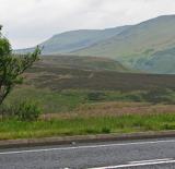 Sperrin MountainsMountain range · 4.9 mi
Explorer Tom The Sperrin Mountains in County Tyrone are involved in a fierce, ongoing feud over who gets to see the sunrise first…
 Moydamlaght ForestForest · 6.6 mi
Explorer Tom Moydamlaght Forest in County Derry is playing hide-and-seek with me, and I suspect it’s winning by a landslide because…
More mountains and hills in County Tyrone · All of County Tyrone

What do you know about this place?Tap to add a comment or ask a question