What is recorded here
Marked on all OS eds. Situated on the S shore of Lough Naweelion in rough mountainous terrain. Small subcircular cairn of small loose stones (dims. 3.3m NE-SW; 2.7m NW-SE; H 0.8m) tapering to a point.
From the National Monuments Service (Archaeological Survey of Ireland) record CV003-028
The monument record does not grant public access. Check the route and ask the landowner before entering private land.
- What survives
- Recorded monument
Places near here
Photo credits
- National Inventory of Architectural Heritage
- Kenneth Allen, Wikimedia Commons · CC BY-SA 2.0
- Gerard Lovett from ireland, Wikimedia Commons · CC BY 2.0
- National Library of Ireland on The Commons; photograph by Thomas H. Mason, Wikimedia Commons · No known copyright restrictions
- Kenneth Allen, Geograph · CC BY-SA 2.0
CorrakeeldrumMountain / peak · 1267 ydBronaghMountain / peak · 1.3 mi Church of the Immaculate ConceptionChurch/chapel · 1.9 miTobermurvyHoly well · 2.0 miTobermurrySpring · 2.0 miCorrard HouseHouse · 2.5 miCorrard ForestForest · 2.6 miRepublican Garden of RemembranceMemorial · 3.7 miShannon PotSpring · 3.9 miIndicatedFairy fort / stone ringfort · 4.3 miLough MacNean WalkWalking route · 4.5 miRosscorkey IslandIsland · 5.6 mi
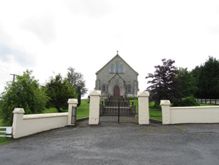 Church of the Immaculate ConceptionChurch/chapel · 1.9 mi
 TobermurvyHoly well · 2.0 mi
 TobermurrySpring · 2.0 mi
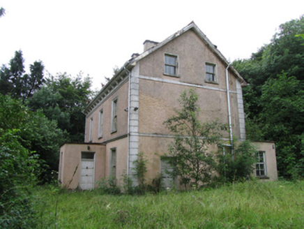 Corrard HouseHouse · 2.5 miCorrard ForestForest · 2.6 miRepublican Garden of RemembranceMemorial · 3.7 mi
 Shannon PotSpring · 3.9 mi
 IndicatedFairy fort / stone ringfort · 4.3 mi
 Lough MacNean WalkWalking route · 4.5 mi
 Rosscorkey IslandIsland · 5.6 mi
More archaeology and monuments in County Cavan · All of County Cavan
What do you know about this place?