What is recorded here
The Canal at Crossmoyle was built a little north of the route drawn on the map. Other waterways let you get lost once you’re in a boat; this one had gone astray before they put the water in.
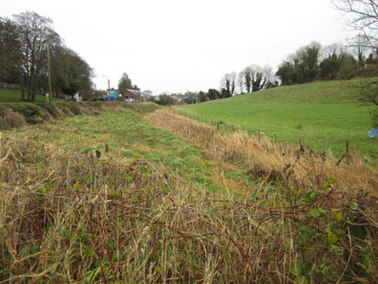
Disused section of Ulster Canal, built c.1840. Consists of approximately three hundred metres of overgrown canal channel from concrete culvert at south-west end which provides access to field from Cavan Road at townland boundary between Crossmoyle and Teehill, past restored Ulster Canal Stores building where there is another overgrown concrete culvert to marshy area north-east of these structures. Water level of narrow channel appears to be mostly around one metre below surrounding banks but has had section of north-western bank raised to facilitate car parking area for Canal Stores facility. Former harbour in front of Stores building has also been filled in level with bank on opposite south side of canal. No historic masonry or features visible on this stretch of canal. Remains of single circular-plan stone pier holding wrought-iron field gate onto former roadway abandoned when canal was constructed directly opposite existing Canal Stores building.
This surviving section of the Ulster Canal was built between 1834 and 1841 to plans by Directors General of Inland Navigation engineer, John Killaly. Work was completed by contractor William Dargan following Killaly's death in 1832 and the canal linked Lough Neagh with Lough Erne up to 1931 when it was closed and drained. The intended route of the canal is indicated on the 1834 Ordnance Survey of the area although the canal was actually constructed slightly north of this proposed route. This site continues to provide a habitat for aquatic species as well as forming an essential part of the context for the former Canal Stores building which is presently in use as a heritage and visitor facility. Although it bears only partial resemblance to its original appearance, together with other surviving locks, bridges and structures, this stretch of canal continues to illustrate an important feature of civil engineering in Clones. Plans to reopen the canal, if realised, would see the canal in use again, as a recreational waterway.
From the Buildings of Ireland (National Inventory of Architectural Heritage) record 41304070
This does not grant access. Most recorded buildings are privately owned; view them only from public ground unless the owner allows entry.
Places near here
 Ulster Canal Stores Visitor CentreHeritage attraction · 17 yd
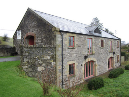 Ulster Canal StoresStore/warehouse · 18 yd
 Clones Masonic HallMasonic lodge/hall · 216 yd
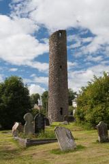 Round Tower330 yd
 Shrine in CrossmoyleShrine · 342 ydCastleCastle, motte and bailey · 359 yd
 The Cassandra Hand CentreMuseum · 405 ydBawn in CrossmoyleBawn · 579 ydClontivrin Grave YardArchaeological place · 1.0 mi
 European Yew1.4 miSaint John's WellSpring · 2.2 mi
 Common Lime2.5 mi
Pictures: Kenneth Allen, Geograph · CC BY-SA 2.0; National Inventory of Architectural Heritage; Andreas F. Borchert, Wikimedia Commons · CC BY-SA 4.0; Sitomon, Wikimedia Commons · CC BY-SA 2.0; Alvesgaspar, Wikimedia Commons · CC BY-SA 3.0
More historic places in County Monaghan · All of County Monaghan
What do you know about this place?