What is recorded here
Calvay light is a lighthouse in Na h-Eileanan Siar, Scotland.
From OpenStreetMap (© OpenStreetMap contributors) w1299996532
Places near here
Photo credits
- Alpin Stewart, Wikimedia Commons · CC BY-SA 2.0
- Colin Wheatley, Wikimedia Commons · CC BY-SA 2.0
- Peter Barr, Wikimedia Commons · CC BY-SA 2.0
- Colin Smith, Wikimedia Commons · CC BY-SA 2.0
- Roger McLachlan, Wikimedia Commons · CC BY-SA 2.0
- Tom Richardson, Wikimedia Commons · CC BY-SA 2.0
- Mick Garratt, Wikimedia Commons · CC BY-SA 2.0
- Gordon Hatton, Wikimedia Commons · CC BY-SA 2.0
- Lis Burke, Wikimedia Commons · CC BY-SA 2.0
- Rob Farrow, Wikimedia Commons · CC BY-SA 2.0
 CalbhaighIsland · 289 yd
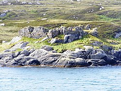 Calbhaigh castleCastle, fort or tower · 487 yd
 Calbaigh Castle and salmon farmCastle, fort or tower · 498 yd
 A' Mhaol BhuidheHeadland · 1238 yd
 Bàgh MarulaighBay · 1728 yd
 Ruined bridge across the Abhainn MarulaighHeritage place · 1.1 mi
 Beinn Ruigh ChoinnichMountain / peak · 1.4 mi
 GasaighIsland · 1.5 mi
 South Uist, HairteabhaghCottage (19th Century) - (20th Century), Peat Stand · 1.5 mi
 Poll Airigh Nan GallanFish Trap · 1.7 mi
 HairtebreacMountain / peak · 1.9 mi
 Monument and topless weather-vaneHeritage place · 1.9 mi
More historic places in Na h-Eileanan Siar · All of Na h-Eileanan Siar

What do you know about this place?Tap to add a comment or ask a question