DDiscover AloneMapAbout

Cahermacnaghten

Fairy fort / stone ringfort
Computer-made picture that does not show CahermacnaghtenNot a photo of this monument
Computer-made picture. It does not show this monument. · Report the wrong picture

The monument record does not grant public access. Check the route and ask the landowner before entering private land.

What do you know about this place?Tap to add a comment or ask a question

What you write will be public.

What is recorded here

On level ground in the centre of Cahermacnaghten townland on the Burren plateau with higher ground c. 500m to N and S. This lies within a very large field system outlined on the RMP (1996) covering c. 12km square and stretching from Lissylisheen, 2km to the SE to Lisdoonvarna 5km to the W…

Read the whole record
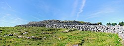
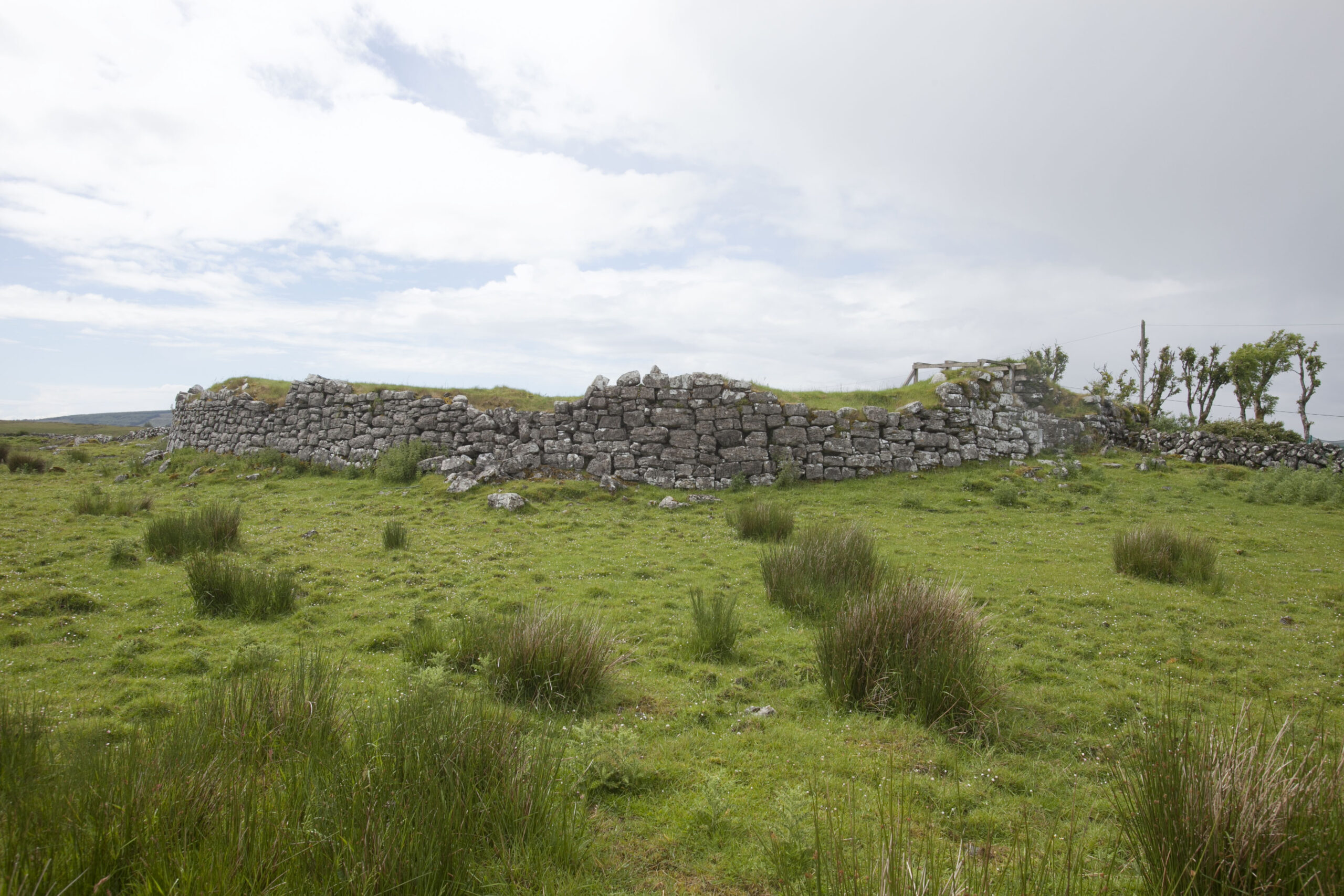
On level ground in the centre of Cahermacnaghten townland on the Burren plateau with higher ground c. 500m to N and S. This lies within a very large field system outlined on the RMP (1996) covering c. 12km square and stretching from Lissylisheen, 2km to the SE to Lisdoonvarna 5km to the W (CL009-001001-/CL005-116---*/CL008-045001*). FitzPatrick (2008, 58-9) notes that this cashel, known as ‘Cathair Mhic Neachtain’ is named in a document of 1606 as the ‘ceann áit’ of the ‘leith sheisre (half quarter)’ of Cahermacnaghten. FitzPatrick continues ‘The cashel itself can be interpreted as the residence of the Ó Dábhoireann brehon in the first instance, possibly as early as the twelfth century and probably by 1364 when the Uí Dhábhoireann were established as ollamhs in north Clare … . It was home to both Aodh and Cosnamhach Ó Dábhoireann in the early seventeenth century after they divided the contents of the “ceann áit” between them including a partible division of the houses within the cashel [see CL009-001012- and CL009-001049- to CL009-001052-]. As part of that land division process, the “leith sheisre” itself was also irrevocably split into two “ceathrú mír” in 1606… . Whether the cashel was ever actually used as the location for the law school of the brehon line cannot be answered at this time, but the distinctive late medieval building known as “Cabhail Tighe Breac”, sequestered in the southwestern end of the “leith sheisre” has many attributes that might lend themselves to that purpose.’ [see CL009-001009- for Cabhail Tighe Breac]. This cashel has the designation ‘Site of O’Loughlin’s Castle’ on the OS first edition 6-inch map but according to FitzPatrick (ibid., 59) this is in error and is likely to refer to the castle in Ballymahony townland (CL009-014002-) a short distance to the S. This is a circular cashel (ext. diam. 38.8m; int. diam. 33.8m) with an entrance at E. The walls (Wth 1.7-3.3m; ext. H 1.8m at W to 2.5m at E) have an external batter all around and are built with roughly squared large blocks of limestone with a rubble core. Vertical joints can be seen on the outer face varying from 2 to 5m apart. The interior ground level is raised almost to the top of the surviving walls suggesting a long period of habitation. FitzPatrick (2009, 291-2) describes the entrance as follows: ‘The entrance consists of a small external lobby area that leads into the ground floor (2.55 by 2.50m) of what was formerly a modest two-storey gatehouse. The gatehouse projects westward slightly beyond the internal line of the cathair wall into the garth of the site. Its walls are built of large and small, very roughly coursed blocks of flat-bedded facing stones with a rubble and mortar core that would have been standard in late-medieval wall construction. Two roughly hewn, punch-dressed corbels project out from the N wall. These and two former correspondents on the opposite S wall supported beams that carried a timber upper floor.’ FitzPatrick (ibid.) also noted a very large cut and punch-dressed bowed arch-stone in an adjacent boundary and noted that a pair of cut and punch-dressed arch-stones from a semi-pointed doorway were found in topsoil in the field to the W in 2006. A punch-dressed hanging eye was noted as still being in position in 1902 (Macnamara 1912-12, 67). Foundations of 5 houses can be made out arranged around the perimeter. The largest house (CL009-001012-) lies S of centre and the grass-covered foundations of two other houses (CL009-001049- and CL009-001050-) are aligned E-W in the N quadrant, 3m apart. Two other houses (CL009-001051- and CL009-001052-) lie at W and SE. Cahermacnaghten is a National Monument in state care, no. 354. The following images have been uploaded: CL009-001010-_01.jpg Aerial view of cashel. CL009-001010-_02.jpg General view from SW. CL009-001010-_03.jpg External wall construction from SW. Revised by: Mary Tunney Date of revision: 15 September 2020

From the National Monuments Service (Archaeological Survey of Ireland) record CL009-001010

Places near here

Photo credits
  • Gordon Hatton, Wikimedia Commons · CC BY-SA 2.0
  • Maker not stated on source page, ru.pinterest.com
  • Maker not stated on source page, en.wikipedia.org
  • Maker not stated on source page, www.jamesatruett.com
  • Maker not stated on source page, heritageireland.ie
  • Maker not stated on source page, www.dreamstime.com
  • Maker not stated on source page, commons.wikimedia.org
  • Maker not stated on source page, au.pinterest.com
  • Maker not stated on source page, tr.pinterest.com
  • Maker not stated on source page, za.pinterest.com
Cahermacnaghten CashelHeritage attraction · 2 yd

Explorer Tom Cahermacnaghten Cashel sits in a Clare farming field where the Burren appears to have left its stones lying about for a…

Site of OLoughlins CastleHouse, 16th century · 8 yd

Explorer Tom O’Loughlin’s Castle is actually just the foundations of a house that got confused about what it was supposed to be. If…
Enclosure in CahermacnaghtenEnclosure · 191 yd

Explorer Tom Enclosure in Cahermacnaghten is haunted by a bird that refuses to leave, despite everyone telling it to go away and…
Graveyard in CahermacnaghtenGraveyard · 191 yd

Explorer Tom Graveyard in Cahermacnaghten bragged about surviving a storm that wasn’t even on the radar. It’s mentioned in a 1606…
Fairy fort / stone ringfort in CahermacnaghtenFairy fort / stone ringfort · 815 yd

Explorer Tom This other spot in Cahermacnaghten wants 'Here Lies A Stone Circle That Tried Its Best' engraved on its tombstone…

Church (in ruins)School · 948 yd

Explorer Tom Church in Cahermacnaghten was originally a medieval house, which means it switched careers after retirement. The…

Fairy fort / stone ringfort in Cregavockoge,lissylisheenFairy fort / stone ringfort · 1015 yd

Explorer Tom Fairy fort / stone ringfort in Cregavockoge, Lissylisheen would spill its secrets after three pints, but right now it’s…

Fairy fort / earthen ringfort in BallymahonyFairy fort / earthen ringfort · 1443 yd

Explorer Tom Ballymahony means 'The Place Where You Definitely Didn't Check the Map,' I invented that on the spot. It's sitting in…

Site of Lissylisheen CastleCastle, tower house · 1526 yd

Explorer Tom Site of Lissylisheen Castle is basically a fancy pile of dirt with attitude. The name probably means 'The Place Where…

Fairy fort / stone ringfort in CahermaanFairy fort / stone ringfort · 1556 yd

Explorer Tom Fairy fort / stone ringfort in Cahermaan hosted a dance that went so far, someone broke their ankle and blamed the…

Fairy fort / earthen ringfort in DoonyvardanFairy fort / earthen ringfort · 1682 yd

Explorer Tom Fairy fort / earthen ringfort in Doonyvardan is actually run by a dog who thinks he’s the landlord of the whole boggy…

Killeany ChurchRuins · 2.0 mi

Explorer Tom Killeany Church thinks the road leading to it is too noisy and rude, so it just turns its back on it. The stones are…

More archaeology and monuments in County Clare · All of County Clare

Add to this placeAdd a picture Add a detailed tip Add a story

Explore the map1,095,414 places to discover

Next place · or swipeCahermacnaghten Cashel