
What is recorded here
On a very gentle E-facing slope, in pasture overlooking the Boolree river. Depicted as a large enclosure named Caherloghan on all OS historic mapping. A roughly circular area (c. 40m N-S; c. 38m E-W) defined by the grass-covered remains of a stone wall (int. H 0.5m; ext. H 1.6m; Wth at top 3.4m; overall Wth 10.7m).…
Read the whole record
From the National Monuments Service (Archaeological Survey of Ireland) record CL035-044
Places near here
Photo credits
- Maker not stated on source page, en.m.wikipedia.org
- Maker not stated on source page, za.pinterest.com
- Maker not stated on source page, www.wikidata.org
- Maker not stated on source page, commons.wikimedia.org
- Maker not stated on source page, www.pinterest.com
- Maker not stated on source page, www.dreamstime.com
- P L Chadwick / Geograph Ireland, www.geograph.ie
- Natasha Barton, credited by The Clare Echo, www.clareecho.ie
- Mike Searle, Wikimedia Commons · CC BY-SA 2.0
- National Inventory of Architectural Heritage
 Enclosure in CaherloghanEnclosure · 99 yd
Explorer Tom Enclosure in Caherloghan in Clare would say in a job interview that it has excellent stone management skills and great…
 Megalithic structure in CaherloghanMegalithic structure · 440 yd
Explorer Tom Megalithic structure in Caherloghan has no description because the archive is busy, so I’m guessing it’s a very shy…
 Fairy fort / earthen ringfort in Moymore (tulla Upper By.)Fairy fort / earthen ringfort · 1106 yd
Explorer Tom Fairy fort / earthen ringfort in Moymore bragged about surviving a storm that flattened three fences nearby. It’s still…
 Fairy fort / stone ringfort in Dangan (bunratty Upper By.)Fairy fort / stone ringfort · 1266 yd
Explorer Tom Fairy fort or stone ringfort in Dangan would post a photo of its collapsed wall and caption it 'vintage aesthetic.' The…
 Megalithic tomb in Toonagh (bunratty Upper By.)Megalithic tomb · 1481 yd
Explorer Tom Megalithic tomb in Toonagh has very strong opinions on modern buildings, specifically that they’re all ‘flimsy…
 Cist in FomerlaCist · 1578 yd
Explorer Tom Cist in Fomerla has a retirement plan involving napping under a rock and letting the moss do all the hard work. It’s a…
 Clooney Quin GAA pitchGAA ground · 2.4 mi
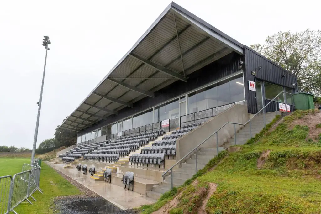 Páirc an Dalaigh, TullaGAA ground · 2.6 mi
 Ballymarkahan Castle (in Ruins)Castle, tower house · 3.6 mi
Explorer Tom Ballymarkahan Castle in County Clare is playing hard to get, which is typical for a tower house with no public access.…
Ballymarkahan CastleCastle · 3.6 miExplorer Tom Ballymarkahan Castle lost its south-east corner and now it's showing off those vaults like it means business. I heard a…
 Knappogue CastleGates/railings/walls · 3.9 mi
Explorer Tom Knappogue Castle in Knopoge is actually just a gateway with carved hands on the piers, which is weirdly specific for a…
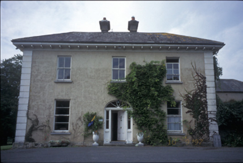 Ballyhannan HouseHouse · 4.3 mi
Explorer Tom Ballyhannan House in Ballyhannan South has interior shutters that might still be hiding secrets from the 1820s. It…
More archaeology and monuments in County Clare · All of County Clare

What do you know about this place?Tap to add a comment or ask a question