Places near here
Photo credits
- Neville Goodman, Geograph · CC BY-SA 2.0
- National Inventory of Architectural Heritage
- Maria Teresa Satta, Wikimedia Commons · CC BY-SA 4.0
- Mike Searle, Wikimedia Commons · CC BY-SA 2.0
- Gareth James, Wikimedia Commons · CC BY-SA 2.0
- Sitomon, Wikimedia Commons · CC BY-SA 2.0
- National Library of Ireland on The Commons, Wikimedia Commons · No restrictions
- Peter Gerken, Geograph · CC BY-SA 2.0
- Marathon, Geograph · CC BY-SA 2.0
- Ian S, Wikimedia Commons · CC BY-SA 2.0
- Humphrey Bolton, Geograph · CC BY-SA 2.0
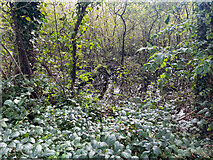 Sheheree Bog Nature ReserveNature reserve · 1.3 mi
Explorer Tom Sheheree Bog Nature Reserve in County Kerry is basically a giant swampy trampoline that nobody maintains. I bet the guy who drew up the map just said 'put a bog there' and went to get a sandwich, leaving us to figure out if it's safe. Linger, it's not going anywhere and neither should you.
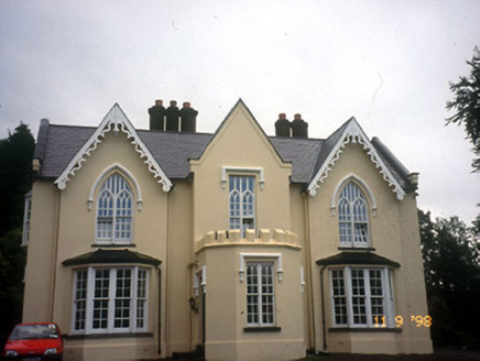 WoodfordHouse · 1.3 mi
Explorer Tom Woodford in Lissyviggeen is triple-gabled because one map maker got really drunk before drawing it and just added extra roofs for fun. It looks like a castle that lost a fight with a library and won on style points. Find a local and ask them the real story, then come back and tell me.
 Lissivigeen Stone CircleHeritage attraction · 1.4 mi
Explorer Tom Lissivigeen Stone Circle is home to the Seven Sisters, who are surrounded by their parents standing awkwardly in the background. The bishop refused to visit because he was terrified the stones would start a gossip session about his hat. Go in good boots and better humour.
 Flesk CastleCastle · 1.4 mi
Explorer Tom Flesk Castle is arguing with a fairy about who gets the best parking spot. The wind has been picking on its roof for centuries, probably because it looks like it’s trying to fly away. Grand place for a sulk or a snog, your call.
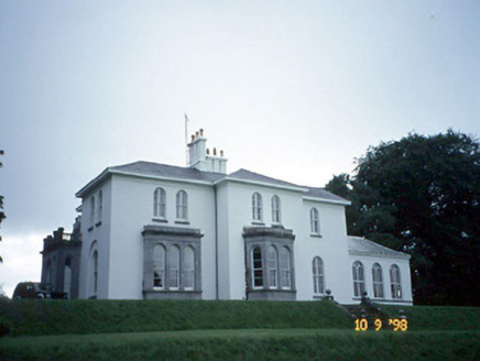 Coolclogher HouseCountry house · 1.7 mi
Explorer Tom Coolclogher House was built after two lads bet a tenner over a pint in 1850. The Italianate style is a bit much, but hey, someone won. It's free, it's odd, what more do you want?
 Muckross AbbeyVisitor attraction · 2.1 mi
Explorer Tom Muckross Abbey in Kerry gave up meat for Lent but probably snuck some bacon in its windows just to spite the monks who built it all those years ago. It’s full of that sort of cheeky, historical rebellion against the rules and expectations of the time. Stop the car, it's worth the hazard lights.
 European Yew2.1 mi
Explorer Tom Two families are feuding over this European Yew in County Kerry, purely because they can't agree on the view. It’s just a tree, but their pride is massive. Have a sandwich here and call it a heritage lunch.
 McCarthy Mor CastleCastle · 2.1 mi
Explorer Tom McCarthy Mor Castle’s New Year's resolution is to stop falling down, but it’s already failed twice this decade. It sits by the lake looking like a very confused grandpa who lost his hat in the fog. Count the crows, then count again.
 Castlelough BayBay · 2.5 mi
Explorer Tom Castellough Bay has a bird that refuses to leave no matter how much the wind tries to blow it away, and frankly, I envy its commitment to staying put. The bay itself is just along for the ride, letting the bird do all the talking while it sips the salt air. Bring a map, get lost anyway, that's the fun.
 Monsignor Hugh O'Flaherty MemorialMemorial · 2.9 mi
Explorer Tom The Monsignor Hugh O'Flaherty Memorial in County Kerry thinks the road leading to it is a personal insult to its dignity and posture. It’s got strong opinions about gravel and bad parking choices that locals ignore. Mind the nettles, they're the real guards here.
 Cow IslandIsland · 3.2 mi
Explorer Tom Cow Island is probably having a secret party when nobody's looking, complete with bad music and damp grass. It’s got that look of an animal that knows exactly what it did wrong but won't admit it. Perfect detour when the satnav has a meltdown.
 River WalkWalking route · 3.5 mi
Explorer Tom River Walk had an escape plan involving a jaunting car and a very confused horse, which is why it's always wandering off. The water looks deep enough to swallow your secrets whole without a hiccup. Take the long way round, it deserves the effort.
More archaeology and monuments in County Kerry · All of County Kerry

What do you know about this place?Tap to add a comment or ask a question