What is recorded here
Depicted on 1842 OS 6-inch map as small rectangular structure (L c. 10m) adjoining NE side of square enclosure (c. 15m NE-SW by c. 12m NW-SE), within SW half of rectilinear enclosure (c. 40m NE-SW; c. 20m NW-SE), with laneway extending N from N corner. Site now forested and inaccessible. Bowman (1934, 610) recorded 'remains of rectangular stone fort (23yd by 10yd; 10ft T) of dry stone work' and foundation of several other enclosures, 'in centre of bog, on hill-top in P. Sullivan's land...most of the stones have been removed by cottage contractors'. According to local tradition, a Quaker named Meelaun resided here during the 'hunting and fowling season' (ibid., 610-11) and Bowman noted that the remains of a road leading to it can still be seen. Cremen (1909, 59) was informed that herdsmen frequently availed of the 'stone huts' of the 'Cahir' and the place became known as 'The Kerryman's bed'; he could find no trace of it.
Depicted on 1842 OS 6-inch map as small rectangular structure (L c. 10m) adjoining NE side of square enclosure (c. 15m NE-SW by c. 12m NW-SE), within SW half of rectilinear enclosure (c. 40m NE-SW; c. 20m NW-SE), with laneway extending N from N corner. Site now forested and inaccessible. Bowman (1934, 610) recorded 'remains of rectangular stone fort (23yd by 10yd; 10ft T) of dry stone work' and foundation of…
From the National Monuments Service (Archaeological Survey of Ireland) record CO050-150
The monument record does not grant public access. Check the route and ask the landowner before entering private land.
- What survives
- Recorded monument
Places near here
Photo credits
- Jonathan Thacker, Geograph · CC BY-SA 2.0
- National Inventory of Architectural Heritage
- kevin higgins, Wikimedia Commons · CC BY-SA 2.0
- Tim Sheerman-Chase, Wikimedia Commons · CC BY 2.0
- Jonathan Thacker, Wikimedia Commons · CC BY-SA 2.0
- Sitomon, Wikimedia Commons · CC BY-SA 2.0
- The Speckled Bird, Wikimedia Commons · CC BY-SA 4.0
- Ceoil ( talk ) ( Uploads ), Wikimedia Commons · Public domain
Knockduff Wind FarmVisitor information · 1577 yd Eagle's NestMountain / peak · 2.1 miLacka BridgeBridge · 3.3 miLacka BrBridge · 3.3 miNew TipperaryVisitor information · 4.1 miSt Abigails WellHoly well · 4.6 miLisheentoortaghFairy fort / earthen ringfort · 4.7 miMusheraMountain / peak · 6.1 miEuropean Yew9.6 miEuropean Yew9.6 miKanturk CastleHeritage attraction · 9.8 miCarrigaphooca CastleCastle · 13 mi
 Eagle's NestMountain / peak · 2.1 mi
 Lacka BridgeBridge · 3.3 mi
 Lacka BrBridge · 3.3 mi
 New TipperaryVisitor information · 4.1 mi
 St Abigails WellHoly well · 4.6 mi
 LisheentoortaghFairy fort / earthen ringfort · 4.7 mi
 MusheraMountain / peak · 6.1 mi
 European Yew9.6 miEuropean Yew9.6 mi
 Kanturk CastleHeritage attraction · 9.8 mi
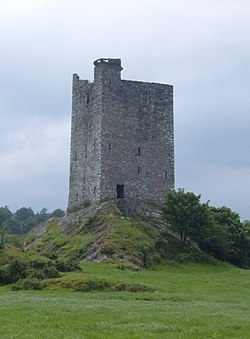 Carrigaphooca CastleCastle · 13 mi
More historic places in County Cork · All of County Cork
What do you know about this place?