What is recorded here
Caher is a fairy fort or earthen ringfort in County Clare, Ireland.
From the National Monuments Service (Archaeological Survey of Ireland) record CL068-021
The monument record does not grant public access. Check the route and ask the landowner before entering private land.
- What survives
- Recorded monument
Places near here
LisnalarabauniaFairy fort / earthen ringfort · 664 yd Donagrogue CastleHouse · 823 ydSt Senan's WellSpring · 1.1 miSaint Imy's Catholic ChurchChurch/chapel · 1.2 miBallymacrinan BayBay · 2.6 miClonderalaw BayBay · 2.6 miSt. Senan's WellSpring · 4.6 miGrave YardGraveyard · 4.8 miGlin CastleCastle · 5.4 miCarrig IslandIsland · 5.8 miCarrigafoyle CastleCastle · 5.9 miSiege of Carrigafoyle CastleSiege · 5.9 mi
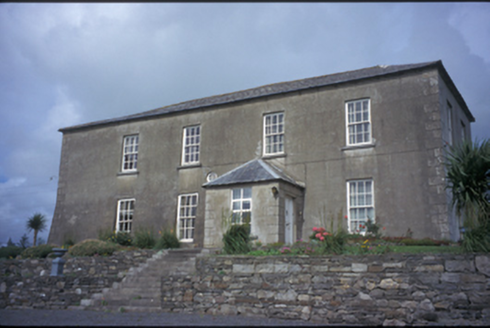 Donagrogue CastleHouse · 823 yd
 St Senan's WellSpring · 1.1 mi
 Saint Imy's Catholic ChurchChurch/chapel · 1.2 mi
 Ballymacrinan BayBay · 2.6 mi
 Clonderalaw BayBay · 2.6 mi
 St. Senan's WellSpring · 4.6 mi
 Grave YardGraveyard · 4.8 mi
 Glin CastleCastle · 5.4 mi
 Carrig IslandIsland · 5.8 mi
 Carrigafoyle CastleCastle · 5.9 mi
 Siege of Carrigafoyle CastleSiege · 5.9 mi
Pictures: National Inventory of Architectural Heritage; Tiger, Geograph · CC BY-SA 2.0; P L Chadwick, Geograph · CC BY-SA 2.0; Charles W Glynn, Wikimedia Commons · CC BY-SA 2.0; P L Chadwick, Wikimedia Commons · CC BY-SA 2.0; Graham Horn, Geograph · Creative Commons Attribution-ShareAlike 2.0; Garry Dickinson, Wikimedia Commons · CC BY-SA 2.0; Colin Park, Geograph · CC BY-SA 2.0; Arcaist, Wikimedia Commons · CC BY-SA 3.0; Borvan53, Wikimedia Commons · CC BY-SA 3.0
More archaeology and monuments in County Clare · All of County Clare
What do you know about this place?