What is recorded here
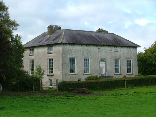
Detached five-bay two-storey over basement country house, built c.1780. Set within own grounds with outbuildings to rear. Hipped triple-span slate roof to front with rendered chimneystacks and tooled stone eaves modillions to front. Roughcast render to walls. Window openings with replacement timber sash windows. Round-headed door opening with tooled limestone surround and central keystone. Replacement timber door with spider web fanlight. Tooled stone steps to entrance. Segmental integral carriage opening to rear elevation. Tooled stone gate piers to driveway with stone capping. Plinth stone wall with cast-iron gates. Multiple-bay three-storey outbuildings to rear with corrugated-iron roofs and random coursed sandstone walls. Window openings with red brick surround, timber panes and segmental-headed carriage archways with sandstone voussoirs. Flat-arched door openings. Access to outbuildings through segmental-headed carriage arch in south wing.
Cadamstown House, built by the Manifold family who were Cromwellian planters from Kent, is a substantial country house with appealing ranges of agricultural outbuildings. With Neo-Classical elements including regular proportions, eave modillions, and a delicate fanlight, the country house is architecturally significant. Alterations to the lower storey including blocked up entranceways suggest intervention and modification throughout the years. The country house has been well maintained. Noted by local historian Paddy Heaney, this house and its original owners, the Manifolds, played an important part in the history of Cadamstown as the principal employers in the village and surrounding area, running a dairy, flour mill and even an illegal shebeen or still at Cadamstown Mill.
From the Buildings of Ireland (National Inventory of Architectural Heritage) record 14817005
This does not grant access. Most recorded buildings are privately owned; view them only from public ground unless the owner allows entry.
Places near here
.jpg/250px-Cadamstown_Bridge_(sq).jpg "Photo: Digital Eye, Wikimedia Commons · CC BY-SA 4.0") Bridge in CadamstownBridge · 313 yd
Bridge in CadamstownBridge · 313 yd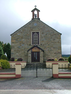 Saint Luna's Catholic ChurchChurch/chapel · 524 ydBallymacadam Castle in ruinsCastle, unclassified · 1011 yd
 ToberlugnaHoly well · 1531 ydGraveyard in LetterGraveyard · 1586 ydKinnitty ForestForest · 1.1 miGiant's Grave LoopWalking route · 1.3 miChurch (in Ruins), Graveyard, CarrigeenChurch · 1.6 miCastle (Site of)Castle, unclassified · 2.4 mi
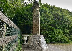 Stone CrossCross, High cross (present location) · 2.5 mi
 Slieve Bloom MountainsMountain range · 4.5 mi
 Sitka Spruce5.1 mi
Pictures: Digital Eye, Wikimedia Commons · CC BY-SA 4.0; National Inventory of Architectural Heritage; Jonathan Thacker, Geograph · Creative Commons Attribution-ShareAlike 2.0; Zepherb, Wikimedia Commons · CC BY-SA 4.0; Mooro1, Wikimedia Commons · CC BY-SA 4.0; Wsiegmund, Wikimedia Commons · CC BY 2.5
More historic places in County Offaly · All of County Offaly
What do you know about this place?