What is recorded here
Identified in centre-line testing (E4110) in advance of the M11 Gorey to Enniscorthy road scheme and set aside for resolution as Mountgeorge 1 (Hardy et al. 2010, 51-2). It is situated on level ground at the bottom of a NW-facing slope with a small NE-SW stream c. 40m to the NW. It was excavated (E4178) by M. McNamara when a section of a winding palaeochannel (Wth 2-4m; D 0.2-0.6m) running generally E-W (exposed L c. 38m) was filled with silts, re-deposited natural and burnt stone layers. An oval pit (dims 1.26m E-W; 0.95m; N-S; D 0.26m) 4.5m NE of a bend in the stream was filled with sandy gravel and clay with pebbles. There was a small burnt stone spread (dims 1.2m x 1.02m; T 0.02m) just W of the pit. All the burnt stone deposits could be re-deposited and no artefacts were recovered. The burnt mound (WX016-045----) is c. 115m to the SW and the fulacht fia (WX016-054----) is c. 80m to the S. (McNamara 2012; 2013)
Compiled by: Michael Moore
Date of upload: 26 November, 2013
Burnt mound in Mountgeorge is a Neolithic ritual or industrial site, dating to the third millennium BCE. Its significance lies in providing evidence of early land use and possibly ceremonial activity in the region.
The monument record does not grant public access. Check the route and ask the landowner before entering private land.
- What survives
- Recorded monument
Places near here
 Fulacht fia in MountgeorgeFulacht fia · 86 yd
 Holy well in MountgeorgeHoly well · 141 yd
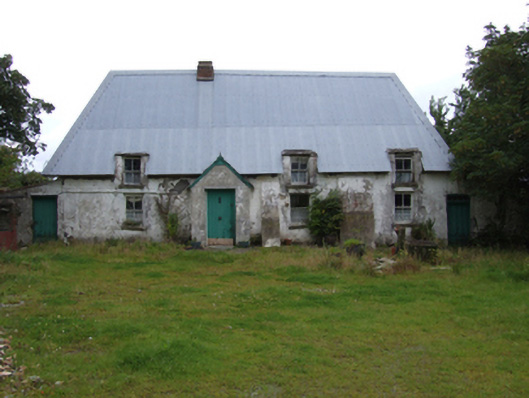 farm housefarm house · 201 yd
 KilnKiln, corn-drying · 726 yd
 The GroveWood · 1509 yd
 The CoilWood · 1660 yd
 Giants BedNamed rock · 1.5 mi
 IndicatedCastle, ringwork · 2.0 mi
 Carrigroe HillMountain / peak · 2.0 mi
 Father Murphy CentreHeritage attraction · 2.1 mi
 Milshoge RockMountain / peak · 2.6 mi
 Ferns Castle (in ruins)Castle, Anglo-Norman masonry castle · 3.0 mi