What is recorded here
No. Burnt mound in Ballymot is a missing place: local information described a twenty-metre spread of heat-shattered stones and charcoal-enriched soil, but marsh, field work and time have taken back the shape. What remains is a chance of heat, water and human hurry in a quiet Cork landscape.
In a marshy part of a tillage field, on a WSW-facing slope and c. 100m to the SW of a standing stone (CO087-070----), which is in the same field. According to local information, there was a spread (diam. c. 20m) of heat-shattered stones and charcoal-enriched soil here. There are no visible remains of this spread. Another possible burnt mound (CO087-126----) lies c. 80m to the N.
The above description is derived from 'The Archaeological Inventory of County Cork. Volume 5' (Dublin: Stationery Office, 2009).
Date of upload: 22 December 2009
Burnt mound in Ballymot is a Bronze Age ritual or industrial site, characterized by a spread of heat-affected stones. Its association with a nearby standing stone suggests possible ceremonial or domestic activity.
This remains an important historical record, but the official description says the monument is no longer visible or has been destroyed. The monument record does not grant public access. Check the route and ask the landowner before entering private land.
- What survives
- No visible remains or recorded as destroyed
Places near here
 Fulacht fia in ParkgarriffFulacht fia · 831 yd
 IndicatedFairy fort / earthen ringfort · 867 yd
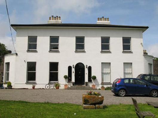 Raffeen Housecountry house · 1431 yd
 sign postsign post · 1443 yd
 Rochestown WoodWood · 1.9 mi
 Passage West Maritime MuseumMuseum · 2.0 mi
 Ronayns CourtHouse, fortified house · 2.4 mi
 Mulcon ValleyWood · 2.4 mi
 Marino PointHeadland · 2.5 mi
 Cork WalksVisitor information · 5.6 mi
 Lavitts QuayMemorial · 5.8 mi
 Enclosure in RaheeneringEnclosure · 1287 yd