
What is recorded here
From the National Monuments Service (Archaeological Survey of Ireland) record WI015-022
Places near here
Photo credits
- Maker not stated on source page, www.pinterest.com
- Maker not stated on source page, en.wikipedia.org
- Andrewmc, Wikimedia Commons · CC BY 3.0
- Maker not stated on source page, www.irelandhighlights.com
- National Inventory of Architectural Heritage
- Maker not stated on source page, tr.pinterest.com
- Maker not stated on source page, commons.wikimedia.org
- J P & M Doyle Ltd / MyHome.ie property listing; individual aerial photographer not named, www.myhome.ie
- Maker not stated on source page, www.thejournal.ie
- P L Chadwick, Wikimedia Commons · CC BY-SA 2.0
 Stone circle in PlezicaStone circle · 909 yd
Explorer Tom Stone circle in Plezica thinks the road leading to it is too fancy for its taste. Eighteen stones stand in a neat row…
 Church in CrehelpChurch · 1119 yd
Explorer Tom Church in Crehelp made Saint Patrick say 'that’s not my fault, it’s the ground’s fault'. He blamed the mud for making…
 Burial ground in CrehelpBurial ground · 1.2 mi
Explorer Tom Crehelp’s burial ground is home to a granite pillar that looks like it got stuck in a jammed window frame. They say…
 Anomalous stone group in ForristeenAnomalous stone group · 1.3 mi
Explorer Tom Anomalous stone group in Forristeen is a disused quarry pit that used to be called a stone circle because we like to…
 Stone circle in ForristeenStone circle · 1.3 mi
Explorer Tom Stone circle in Forristeen has deep suspicion of the postman and will probably throw a rock if he gets too close. It…
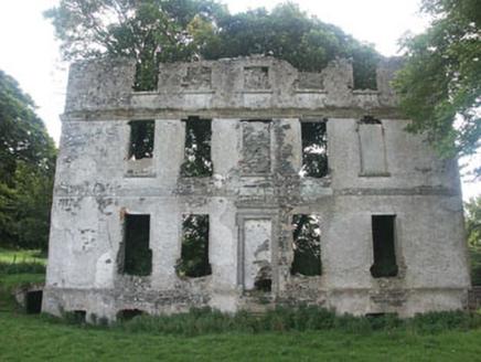 Tober HouseCountry house · 1.5 mi
Explorer Tom Tober House claims to be older than the hills themselves, though we’re not entirely sure if that’s true or just…
 Old ChurchRuins · 1.5 mi
Explorer Tom Old Church would tell you its deepest secret after a few pints: it actually prefers being a ruin to being a church. The…
 Holy well in Tober Demesne,tober Lower,tober UpperHoly well · 1.6 mi
Explorer Tom The holy well in Tober Demesne is unlocated, which is a fancy way of saying 'somewhere near the fence.' A fiddler…
 CastleCastle, unclassified · 1.6 mi
Explorer Tom Castle in Tober Demesne is hiding near the ruined house, probably ordering a chip but no mash because it’s trying to be…
 Dunlavin GAAGAA ground · 1.6 mi
 Fairy fort / earthen ringfort in Dunlavin UpperFairy fort / earthen ringfort · 1.7 mi
Explorer Tom Fairy fort / earthen ringfort in Dunlavin Upper has a family tree that’s basically pure invention. Two doors? It…
 Fair GreenPark · 2.0 mi
Explorer Tom Fair Green in Dunlavin looks like a modest village opening until its triangular shape and memorial ask you to stop. I…
More archaeology and monuments in County Wicklow · All of County Wicklow

What do you know about this place?Tap to add a comment or ask a question