DDiscover AloneMapAbout

Burial in Portmarnock

Burial
Computer-made picture that does not show Burial in PortmarnockNot a photo of this monument
Computer-made picture. It does not show this monument. · Report the wrong picture

The monument record does not grant public access. Check the route and ask the landowner before entering private land.

What do you know about this place?Tap to add a comment or ask a question

What you write will be public.

What is recorded here

A residential development has been completed where the monument stood. Nothing remains. Entirely removed by excavation under licence 16E0613 in advance of development. The results of this excavation were summarised by Gill McLoughlin as follows; 'The excavation comprised the remains of a large sub‐surface ditched…

Read the whole record
A residential development has been completed where the monument stood. Nothing remains. Entirely removed by excavation under licence 16E0613 in advance of development. The results of this excavation were summarised by Gill McLoughlin as follows; 'The excavation comprised the remains of a large sub‐surface ditched enclosure (DU015‐014001-) adjacent to the upstanding Portmarnock mound (DU015‐014----), east of the railway line at Portmarnock and south of Station Road. The archaeological excavation took place over fourteen weeks from the 9th January 2017 with a team of ten archaeologists and six general operatives. Excavation at the site followed previous archaeological monitoring and excavation in relation to Phase 1A of a permitted development immediately to the west of the enclosure site (Planning Ref. F13A/0248). The excavation that is the subject of this report is referred to as Phase 1B (Area 3). During the phase 1A archaeological investigations targeted testing was carried out on the phase 1B enclosure to confirm its existence and its nature and extent. The enclosure was slightly elliptical or sub‐circular in plan and measured a maximum external diameter of 77m east‐west x 70m north‐south (68m east‐west x 60m north‐south internal diameter), with an entrance to the east. A single adult male burial was found within the interior of the ditched enclosure, in the southwest quadrant. The cut (C151) was elongated with rounded corners and measured 2m x 0.8m x 0.6m deep. It was oriented WNW‐ESE and had vertical sides and a flat base. The basal fill (C143) comprised a moderately compact mid‐brown silty clay with occasional charcoal, sea shell and an extended supine skeleton with head to the WNW. This grave cut was recut (C131), but the recut respected the outline of the original cut, indicating that it may have been still been visible at the time of the recut. The recut measured 1.7m x 0.5m x 0.4m deep and there was evidence of burning along the edge of this cut, in particular along the southwest side (C146) where the burning was vertical indicating that it was burnt in situ. The upper fill comprised a moderately compact dark grey/brown silty clay with frequent inclusions of bone, charcoal, seashell, occasional burnt bone and medium sized stones (C132). The inclusions of bone in the upper fill comprised animal bone only. A flint end‐of‐blade convex scraper (16E0613:160) and a cetacean caudal vertebra fragment (16E0613:134) were recovered from this deposit. The cetacean (whale/dolpin/porpoise) caudal fragment has been lightly modified for use as a suspension weight and comes from a small cetacean (Riddler and Trzaska‐Nartowski, Appendix 5.3). It could represent a votive deposit and it is possible that the recut of the grave was for the purpose of depositing this item. The skeletal remains comprised the remains of a male, c.40‐45 years at age of death, estimated to have measured 172.2cm+/‐4.32cm (or 5’9” +/‐ 1.7”) in height, which would have been taller than average for males in early medieval and medieval Ireland. This man suffered from severe degenerative arthritis of the right shoulder and there were indications that the left upper limb was favoured over the right as a result. It was not possible to determine if this was caused by trauma or was due to old age however age at death would suggest the latter. The upper vertebral column was also affected by degenerative arthritis. This condition would have been painful, and probably inhibited this man’s ability to undertake daily activities (Tobin, Appendix 5.6). A sample of bone from the right femur was selected for radiocarbon dating, however the sample did not pass an initial nitrogen test and as such was not suitable for dating. A tooth (#17 in the dental arcade) was subsequently selected and returned a date range of 1545+/‐48 BP (UBA 35733), which was calibrated to AD 410‐607 (2 sigma), placing this individual in the late Iron Age/early medieval transition (QUB, Appendix 5.14). In an attempt to discover any additional information about the individual, such as if or when he may have moved to Portmarnock, three molars were selected for analysis of strontium isotope ratios and concentrations. The results suggest a marine‐based diet throughout the individual’s life, however it was not possible to assess mobility due to the signal being overshadowed by the input of marine resources. It is possible this individual moved but kept a marine‐based diet, but it is also possible that they stayed in the same location, close to the coast all their life (Snoeck, Appendix 5.15)' (McLoughlin 2019, 24-5). See attached photographs and plan of site courtesy of and © Gill McLoughlin of Courtney Deery Heritage Consultancy Ltd. McLoughlin, G. 2019 Final Archaeological Excavation Report, Station Road, Portmarnock, 16E0613. Unpublished archaeological report submitted by Courtney Deery Heritage Consultancy Ltd. to the National Monuments Service on behalf of Sherman Oaks Ltd.

From the National Monuments Service (Archaeological Survey of Ireland) record DU015-014003

Places near here

Photo credits
  • Maker not stated on source page, commons.wikimedia.org
  • Jonjobaker, Wikimedia Commons · CC BY-SA 4.0
  • Maker not stated on source page, www.pinterest.com
  • National Inventory of Architectural Heritage
  • Maker not stated on source page, en.wikipedia.org
  • Maker not stated on source page, www.360cities.net
  • William Murphy from Dublin, Ireland, Wikimedia Commons
  • Maker not stated on source page, stock.adobe.com
  • Maker not stated on source page, www.homestratosphere.com
Earthwork in Snugborough (coolock By.)Earthwork · 828 yd

Explorer Tom Earthwork in Snugborough claims Queen Victoria stopped there for a quick sandwich, but nobody can prove it. It’s a…

Saint Marnock's Church (Portmarnock)Church/chapel · 990 yd

Explorer Tom Saint Marnock's Church in Portmarnock must have taken thousands of cups of tea to build, considering how much effort…

Mapped graveyardGraveyard · 990 yd

Explorer Tom Mapped graveyard in County Dublin is just a dot on the map right now. I bet it's waiting for you to give it a story.…
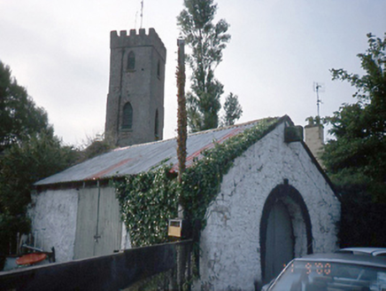
forge/smithy1016 yd

Explorer Tom Forge or smithy in Portmarnock is a single-bay building from 1850 with a horseshoe-shaped entrance. It’s disused now…

Grange AbbeyHouse, 16th/17th century · 1428 yd

Explorer Tom Grange Abbey in County Dublin was described as a large stone house with slate roofing in the Civil Survey. It’s…

Enclosure in KinsaleyEnclosure · 1547 yd

Explorer Tom Enclosure in Kinsaley was supposedly built on a bargain where the devil traded a ring of earth for a single grain of…
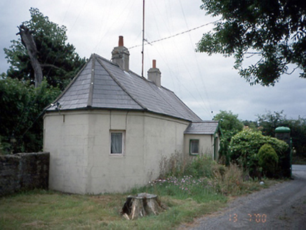
Kinsealy HallGate lodge · 1556 yd

Explorer Tom This Kinsealy Hall gate lodge is from 1860 and has a gable-fronted porch. It’s single-storey and looks quite cozy. The…

Enclosure in Unknown TownlandEnclosure · 1573 yd

Explorer Tom Enclosure in Dublin inspired such bad poetry that even the crows refused to repeat it back to us during our survey.…

Father Collins ParkPark · 1690 yd

Explorer Tom Father Collins Park in Donaghmede has football pitches, a skatepark and a playground, but it also has wind turbines…
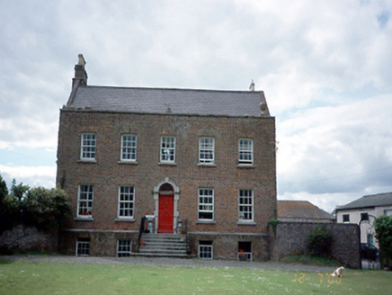
Kinsaley HouseHouse · 1708 yd

Explorer Tom Kinsaley House in Kinsaley was built in 1736 and took a lot of tea to construct. The flanking screen walls are doing…
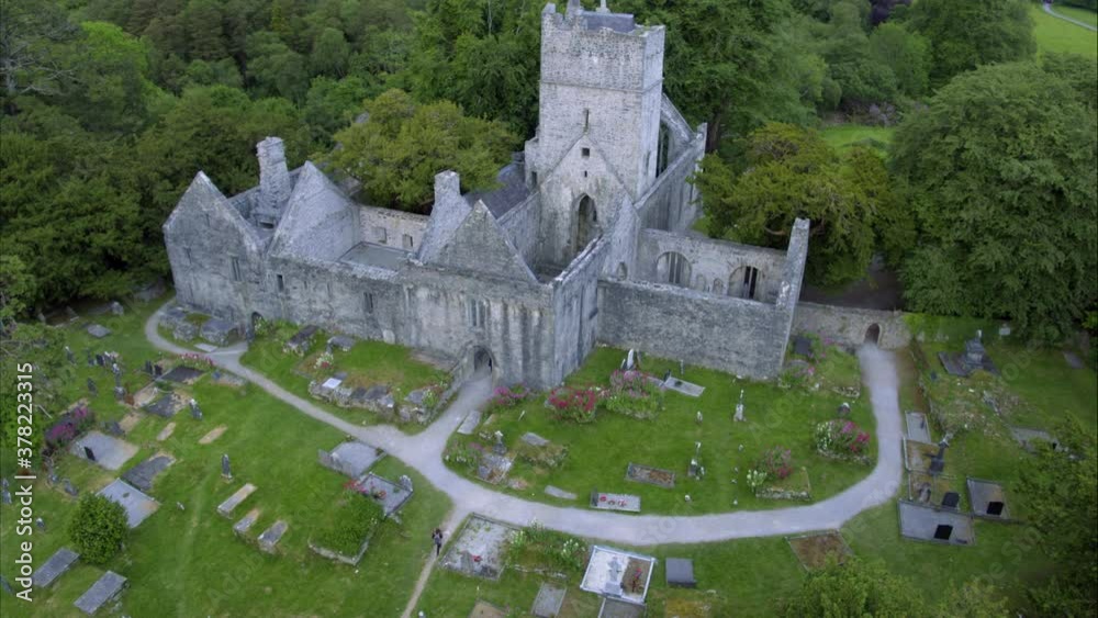
Church in ruins, GraveyardChurch · 1.1 mi

Explorer Tom Church in ruins, Graveyard in Kinsaley is dedicated to St Nicholas and fell apart in the seventeenth century. The nave…

CastleCastle, unclassified · 1.1 mi

Explorer Tom The Castle at Balgriffin Park was mentioned in the Civil Survey as a small castle with a stone house, now just farm…

More archaeology and monuments in County Dublin · All of County Dublin

Add to this placeAdd a picture Add a detailed tip Add a story

Explore the map1,095,414 places to discover

Next place · or swipeEarthwork in Snugborough (coolock By.)