What is recorded here
Excavated by Brian Halpin (02E0811) when 'topsoil-stripping on the Bord Gáis Éireann Pipeline to the West uncovered a series of pits and cut features in Curraheen South townland, Co. Limerick. The largest pit measured 3m by 0.8m, with a maximum depth of 0.33m. It contained three fills, all of which had minor amounts of charcoal and decayed stone. The pits had irregular cuts but were generally U-shaped, with gradually sloping sides to a flat base that reached the water table. They were post-medieval refuse pits and contained much post-medieval/ modern porcelain, animal bone and two horseshoes. Local knowledge of the field indicates that the site was abandoned after the Famine. At a distance of 8.5m north of the main site, a disarticulated human skeleton of post-medieval/modern date was found, partially exposed. Although most of the skull was not present, the remainder of the skeleton was recovered fairly intact, with the bones, though brittle, in a good state of preservation. The skeleton was found in a crouched position, roughly on its left side, with the right arm extended behind the spine, exposing the ribcage vertically. The grave-cut, oriented north-south, measured c. 1.12m and was extremely shallow, lying just under the topsoil, and no remnants of a coffin or shroud were noted. The orientation of the grave and its shallow cut indicate very quick deposition of the corpse. The skeleton appears, on preliminary inspection, to have been that of a late adolescent. The post-medieval date of the associated features, in association with the local knowledge of this site, may indicate that this was the grave of a Famine victim. No grave-goods were noted, nor were other skeletal remains found on the site. The immediate landscape appears to be an abandoned agricultural settlement of post-medieval/modern date.' This description is posted on the web at the following internet address (accessed 3 August 2012): http://www.excavations.ie/
Compiled by: Denis Power
Date of Upload: 8 August 2012
Excavated by Brian Halpin (02E0811) when 'topsoil-stripping on the Bord Gáis Éireann Pipeline to the West uncovered a series of pits and cut features in Curraheen South townland, Co. Limerick. The largest pit measured 3m by 0.8m, with a maximum depth of 0.33m. It contained three fills, all of which had minor amounts of charcoal and decayed stone. The pits had irregular cuts but were generally U-shaped, with…
From the National Monuments Service (Archaeological Survey of Ireland) record LI020-168
The monument record does not grant public access. Check the route and ask the landowner before entering private land.
- What survives
- Recorded monument
Places near here
Photo credits
- National Inventory of Architectural Heritage
- This file is from the Mechanical Curator collection , a set of over 1 million images scanned from out-of-copyright books and released to Flickr Commons by the British Library. View image on Flickr View all images from book View catalogue entry for book ., Wikimedia Commons · Public domain
- Mike Searle, Geograph · Creative Commons Attribution-ShareAlike 2.0
- Peter Gerken, Wikimedia Commons · CC BY-SA 2.0
- Sitomon, Wikimedia Commons · CC BY-SA 2.0
- Wikimedia Commons contributor · Public domain
- Willow, Wikimedia Commons · CC BY 2.5
Fulacht fia in Clogh WestFulacht fia · 262 yd Curraheen HouseCountry house · 704 ydCappagh CastleCastle · 870 ydFlat cemetery in CroaghFlat cemetery · 1253 ydpost box1278 ydLisboy (Site of)Fairy fort / earthen ringfort · 1297 ydClonshire CastleCastle · 2.1 miFlat cemetery in Kiltenan SouthFlat cemetery · 3.3 miCurraghchase Forest ParkForest · 3.7 miEuropean Yew4.1 miAskeaton CastleHeritage attraction · 4.7 miEuropean ash4.8 mi
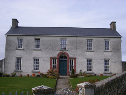 Curraheen HouseCountry house · 704 yd
_p171_LIMERICK_-_CAPPAGH_CASTLE.jpg/250px-NEWENHAM(1830)_p171_LIMERICK_-_CAPPAGH_CASTLE.jpg "Photo: This file is from the Mechanical Curator collection , a set of over 1 million images scanned from out-of-copyright books and released to Flickr Commons by the British Library. View image on Flickr View all images from book View catalogue entry for book ., Wikimedia Commons · Public domain") Cappagh CastleCastle · 870 ydFlat cemetery in CroaghFlat cemetery · 1253 yd
Cappagh CastleCastle · 870 ydFlat cemetery in CroaghFlat cemetery · 1253 yd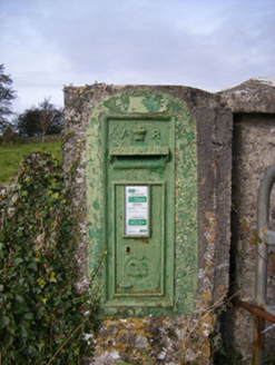 post box1278 ydLisboy (Site of)Fairy fort / earthen ringfort · 1297 yd
 Clonshire CastleCastle · 2.1 miFlat cemetery in Kiltenan SouthFlat cemetery · 3.3 mi
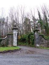 Curraghchase Forest ParkForest · 3.7 mi
 European Yew4.1 mi
 Askeaton CastleHeritage attraction · 4.7 mi
 European ash4.8 mi
More archaeology and monuments in County Limerick · All of County Limerick
What do you know about this place?