
What is recorded here
From the National Monuments Service (Archaeological Survey of Ireland) record TS054-002005
Places near here
Photo credits
- Maker not stated on source page, www.pinterest.com
- A.-K. D., Wikimedia Commons · CC BY-SA 4.0
- Maker not stated on source page, ie.pinterest.com
- Maker not stated on source page, en.wikipedia.org
- Maker not stated on source page, www.dreamstime.com
- National Inventory of Architectural Heritage
- Mike Searle, Wikimedia Commons · CC BY-SA 2.0
 Bullaun stone in LurgoeBullaun stone · 179 yd
Explorer Tom Bullaun stone in Lurgoe sits on an island of dry land surrounded by bog, looking like it’s playing hide-and-seek with…
 Church (in ruins)Church · 182 yd
Explorer Tom Church in Lurgoe is sitting on its own little island of dry land, posting selfies about how isolated it really is. With…
 Derrynaflan ChurchVisitor information · 189 yd
Explorer Tom Derrynaflan Church would order extra chips with its Sunday roast, probably. It’s got that look of a building that’s…
 Fairy fort / earthen ringfort in Ballintogher (graystown Par.)Fairy fort / earthen ringfort · 1.5 mi
Explorer Tom Fairy fort / earthen ringfort in Ballintogher had a matchmaker working there who paired off local cattle with specific…
 Fairy fort / earthen ringfort in Derricknew,lurgoeFairy fort / earthen ringfort · 1.5 mi
Explorer Tom This Derricknew ringfort is completely covered in trees and vegetation, so locals swear if you step on a root, you owe…
 Liskeveen HouseCountry house · 1.7 mi
Explorer Tom Liskeveen House in Liskeveen hums 'I Will Survive' every time it rains. The bridge approach has such fine craftsmanship…
 Grallagh CastleCastle · 1.7 mi
Explorer Tom Grallagh Castle has spent five centuries beside a bridge near Horse and Jockey, looking as though it is still waiting…
 Grallagh Castle (in Ruins)Castle, tower house · 1.7 mi
Explorer Tom Grallagh Castle confused the Vikings so badly they ended up in Tipperary by mistake. It’s a tower house sitting on a…
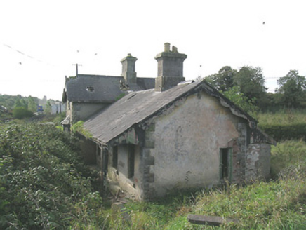 Laffansbridge Railway StationRailway station · 1.8 mi
Explorer Tom Laffansbridge Railway Station has been closed since 1967 but still pretends it’s about to board a train full of…
 Earthwork in LiskeveenEarthwork · 1.9 mi
Explorer Tom Earthwork in Liskeveen hides a scandal about a ruined mill and an old castle stump that’s been sitting there judging…
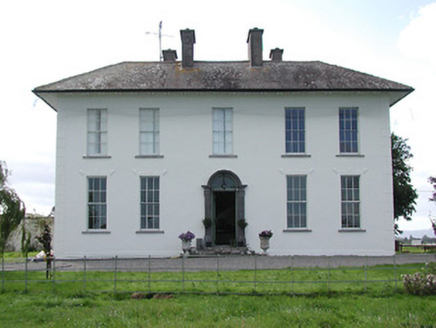 Parkstown HouseHouse · 2.0 mi
Explorer Tom Parkstown House is probably rearranging its furniture when nobody's looking, just to keep things interesting. It's got…
 Kevinsfort HouseHouse · 2.1 mi
Explorer Tom Kevinsfort House in Liskeveen has a weird shape that makes it look like it’s hiding something important behind that low…
More archaeology and monuments in County Tipperary · All of County Tipperary

What do you know about this place?Tap to add a comment or ask a question