DDiscover AloneMapAbout

Burial ground in Knowth

Burial ground
Computer-made picture that does not show Burial ground in KnowthNot a photo of this monument
Computer-made picture. It does not show this monument. · Report the wrong picture

The monument record does not grant public access. Check the route and ask the landowner before entering private land.

What do you know about this place?Tap to add a comment or ask a question

What you write will be public.

What is recorded here

Located in a slight E-W dip or fold between a rise to the N and the ridge of Knowth c. 200m to the S, and it is also at the headwaters of a small WSW-ENE stream. This monument is designated Site M (O’Kelly 1978, 61) and comprises a circular grass-covered area (diam. 80m) defined by an earthen bank with a lot of stone…

Read the whole record
Located in a slight E-W dip or fold between a rise to the N and the ridge of Knowth c. 200m to the S, and it is also at the headwaters of a small WSW-ENE stream. This monument is designated Site M (O’Kelly 1978, 61) and comprises a circular grass-covered area (diam. 80m) defined by an earthen bank with a lot of stone (at W: Wth of base 6m; H 0.8m) separated by a fosse (at W: Wth of top 5m; max. D 0.9m) from an external bank (at W: Wth of base 5.5m; H 0.65m) (max. ext. diam. 105m). There are a number of gaps in the banks, the largest (Wth 11m) being at SSW with another (Wth 6.5m) at SSE, but none appears to be original. Within the inner bank is an eccentrically placed enclosure (diam. 67m) defined by a silted ditch (Wth c. 2-3m) surrounding its domed interior. The field system (ME019-027----) appears to be contemporary and field boundaries are attached to the large enclosure. Seasonal archaeological excavation (02E0726) between 2002 and 2004 revealed that there is a burial ground enclosed by two sub-circular ditches of 6th-10th century AD date at the centre but the relationship with the two visible outer banks is not absolutely established (Stout G & M 2008). The inner enclosure (dims 48m NW-SE; 40m NE-SW) is defined by a ditch, varying in form from V-shaped (Wth 2.45; D 0.9m) to flat-bottomed (Wth 1.95m; D 0.65m) with slight evidence of an internal bank in a sterile yellow clay (Wth 1.8m; H c. 0.2m). A blue glass bead and an Anglo-Saxon mount were in the topsoil over the ditch but charcoal samples from its base produce radiocarbon dates of 573-658 cal. AD. The burial ground may have been further delimited by a NE-SW wall footing with two outer drains at NW as no graves were found NW of these features. A total of 52 burials were exposed in the central and southern portions of the innermost enclosure but the human remains were in a very poor state of preservation. Twenty seven adults and six juveniles were recorded but of the adults only six males and three females could be identified positively. All but three of the burials were orientated approximately W-E with the head at W. One burial produced a radiocarbon date of 597-673 cal. AD. The graves were mainly in shallow, unmarked and unprotected grave-cuts, but at the SE edge of the exposed burials there were 10 slab-lined graves. The middle enclosure (max. ext. dims 74m NW-SE; 62.5m NE-SW) was defined by a ditch (at W: Wth of top 3.7m; D 1.1m: at NE: Wth of top 3.1m; D 0.84m) with traces of an inner bank (at W: Wth 4m; H 0.2m). Charcoal from the bottom of the ditch produced a radiocarbon date of 662-805 cal. AD. There were no burials in the middle enclosure but there was evidence of metalworking at SE in a spread of charcoal enriched soils (D 0.5m) with heat shattered stones and burnt clay fragments over a metalled surface. No furnaces were found but much of the cinders were inorganic in origin. Beneath the cobbled surface were three post-holes, one of which produced a radiocarbon date of 637-769 cal. AD (ibid. 45-9). A bronze baluster-headed ring-pin was found in the topsoil that covered a slab-lined grave. Radiocarbon dates suggest a gradual expansion of the earthworks outwards from c. 600AD for the innermost ditch to c. 700 AD for the middle ditch, but while absolute dates are not available the outer banks may have been constructed between the 9th and 10th centuries. The excavation produced a fine assemblage of early medieval material. Exceptional pieces were a gilt bronze Anglo-Saxon mount, a sperm whale's tooth and a Hiberno-Norse strap end. The combination of burial and metalworking in separate though related parts of the monument suggest it may have been a secular cemetery. In this instance the entry has been revised and updated in the light of recent research. Revised by: Caimin O'Brien Date of upload: 11 November 2013 Amended: 8 June 2021

From the National Monuments Service (Archaeological Survey of Ireland) record ME019-028

Places near here

Photo credits
  • Maker not stated on source page, en.wikipedia.org
  • Martin Richard Phelan, Geograph · CC BY-SA 2.0
  • Tjp finn, Wikimedia Commons · CC BY-SA 4.0
  • Maker not stated on source page, storage.googleapis.com
  • Maker not stated on source page, www.flickr.com
  • Kieran Campbell, Geograph · CC BY-SA 2.0
  • National Inventory of Architectural Heritage
  • Maker not stated on source page, commons.wikimedia.org
  • Maker not stated on source page, www.pinterest.ca
  • Maker not stated on source page, www.dreamstime.com
  • Sitomon, Wikimedia Commons · CC BY-SA 2.0
Passage tomb in NewgrangePassage tomb · 1463 yd

Explorer Tom Passage tomb in Newgrange would use its lotto win to buy more rocks for its perimeter. It’s got a triangular annex that…

Newgrange TumulusPassage tomb · 1519 yd

Explorer Tom Newgrange Tumulus has a hidden message in its stones that says 'don't stand here too long or you'll get cold.' It’s the…
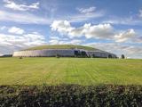
NewgrangeHeritage attraction · 1521 yd

Explorer Tom You reckon you are punctual? Try keeping an appointment for five thousand years. Newgrange is older than Stonehenge…

Indicated Standing StoneStone circle · 1521 yd

Explorer Tom Standing Stone in Newgrange acted as a matchmaker for ancient couples who wanted their wedding photos taken by…

Ceremonial stone setting in NewgrangeCeremonial stone setting · 1565 yd

Explorer Tom Ceremonial stone setting in Newgrange is feuding with the next village over who has the better potatoes. It’s a serious…

Church (in Ruins)Church · 1.1 mi

Explorer Tom Church in Monknewtown is hiding a scandal involving a chaplain named Thomas Alen who probably didn’t clean his boots…

Holy well in MonknewtownHoly well · 1.1 mi

Explorer Tom This Holy well in Monknewtown claims to be older than time itself, but its exact location is so fuzzy you could drive a…

mill (water)1.1 mi

Explorer Tom This Mill in Monknewtown is proud of its red brick chimneystack more than it is of actually grinding grain. It…

Littlewood ForestVisitor information · 1.9 mi

Explorer Tom Littlewood Forest in County Meath is probably posting updates on social media about how majestic it is, complete with…

Saint Patrick's Church GraveyardGraveyard · 2.4 mi

Explorer Tom Saint Patrick's Church Graveyard in County Meath is still seething because that one bishop refused to visit back in the…

Beech ClumpWood · 2.9 mi

Explorer Tom Beech Clump was nearly sold off as a very expensive horse because someone mistook its silhouette for a noble steed in…

Slane CastleCastle · 3.0 mi

Explorer Tom Slane Castle is secretly proud of the potato it grew in the garden last year, treating it like a royal heir. It holds…

More archaeology and monuments in County Meath · All of County Meath

Add to this placeAdd a picture Add a detailed tip Add a story

Explore the map1,095,414 places to discover

Next place · or swipePassage tomb in Newgrange