What is recorded here
Uncovered c. 1978 during building of housing estate on SW side of Kinsale, just outside, and to W of, town walls (CO112-034---). Excavation revealed c. 40 skeletons laid out in single interments in separate grave pits c. 0.4m-0.6m below ground level; orientation E-W; clear rows observed. No coffins used. Arms extended, hands crossed over the genital region. No signs of church or associated structures located. Ring on finger of one skeleton dates site to 16th-17th century (pers. comm. J. Barber).
Uncovered c. 1978 during building of housing estate on SW side of Kinsale, just outside, and to W of, town walls (CO112-034---). Excavation revealed c. 40 skeletons laid out in single interments in separate grave pits c. 0.4m-0.6m below ground level; orientation E-W; clear rows observed. No coffins used. Arms extended, hands crossed over the genital region. No signs of church or associated structures located.…
From the National Monuments Service (Archaeological Survey of Ireland) record CO112-082
The monument record does not grant public access. Check the route and ask the landowner before entering private land.
- What survives
- Recorded monument
Places near here
Photo credits
- Jonjobaker, Wikimedia Commons · CC BY-SA 4.0
- National Inventory of Architectural Heritage
- The Speckled Bird, Wikimedia Commons · CC BY-SA 4.0
- ME, Wikimedia Commons · CC BY-SA 3.0
- Unknown author Unknown author, Wikimedia Commons · Public domain
- David Dixon, Geograph · CC BY-SA 2.0
- Mike Searle, Geograph · CC BY-SA 2.0
- Einaz80, Wikimedia Commons · CC BY-SA 4.0
- Mike Searle, Wikimedia Commons · CC BY-SA 2.0
- Andy Beecroft, Geograph · CC BY-SA 2.0
- Andy Beecroft, Wikimedia Commons · CC BY-SA 2.0
 Saint Multose Church (Kinsale)Church/chapel · 191 yd
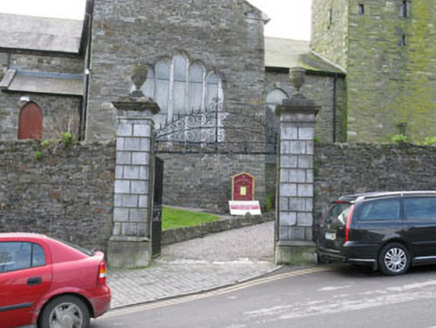 Saint Multose Church (Kinsale)Gates/railings/walls · 214 yd
 GaolCastle, tower house · 371 yd
 Desmond CastleMuseum · 371 yd
 Battle of KinsaleMajor battlefield · 378 yd
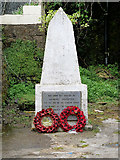 World War I MemorialMemorial · 898 yd
 James FortVisitor information · 1366 yd
.jpg/250px-James_Fort_(Kinsale).jpg "Photo: Einaz80, Wikimedia Commons · CC BY-SA 4.0") Old FortBastioned fort · 1393 yd
Old FortBastioned fort · 1393 yd James' FortArchaeological place · 1399 yd
 Ringrone CastleCastle · 1.0 mi
 Kinsale HarbourBay · 1.6 mi
 Sandy Cove IslandIslet · 2.0 mi
More archaeology and monuments in County Cork · All of County Cork
What do you know about this place?