What is recorded here
Keel, a subcircular burial ground in County Cork, was marked on the 1842 map and lost only when a house garden took it in 1975. Low mounds may have stood above the dead until they were erased. The lane still cuts through the southern half, carrying cars across what was once quiet soil.
Marked 'site of Grave Yard' on 1842 OS 6-inch map and shown as subcircular area (c. 40m N-S; c. 50m E-W) defined by field fence NW->NE, and by broken line NE->NW, with lane running NE-SW through S half. Only NE quadrant shown on 1904 and 1937 OS 6-inch maps. Levelled c. 1975 to make garden for new house. Known locally as "keel". Low mounds in area (now removed) may have marked burials.
The above description is derived from the published 'Archaeological Inventory of County Cork. Volume 3: Mid Cork' (Dublin: Stationery Office, 1997). In certain instances the entries have been revised and updated in the light of recent research.
Date of upload/revision: 14 January 2009
The monument record does not grant public access. Check the route and ask the landowner before entering private land.
- What survives
- Recorded monument
Places near here
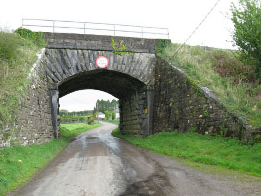 bridgebridge · 524 yd
 Pairc Ath Na hEornaMemorial · 1020 yd
 IndicatedFairy fort / earthen ringfort · 1577 yd
 Graveyard in KilmonaGraveyard · 1607 yd
 Glamcam BrBridge · 1.1 mi
 Garrycloyne Castle (in Ruins)Castle, tower house · 1.1 mi
 LiosFairy fort / earthen ringfort · 1.2 mi
 Castle (Site of)Castle, unclassified · 1.5 mi
 BatsVisitor information · 2.6 mi
 Waterloo Loop WalkWalking route · 2.8 mi
 River Martin Mill & WeirVisitor information · 2.9 mi
 Ring WoodWood · 3.5 mi