
Places near here
Photo credits
- National Inventory of Architectural Heritage
- Duncan Grant, Wikimedia Commons · CC BY-SA 2.0
- Aiden Clarke, Wikimedia Commons · CC BY-SA 2.0
- Richard Webb, Geograph · CC BY-SA 2.0
- Jon Sullivan, Wikimedia Commons · CC0
- Oliver Dixon, Geograph · CC BY-SA 2.0
- Wikimedia Commons contributor · CC BY 2.5
- Neville Goodman, Wikimedia Commons · CC BY-SA 2.0
- Gillaween, Wikimedia Commons · CC BY-SA 4.0
- Sawyer777, Wikimedia Commons · CC BY-SA 4.0
- Mike Searle, Wikimedia Commons · CC BY-SA 2.0
 Cloonfane National SchoolSchool · 635 yd
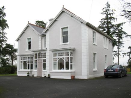 presbytery/parochial/curate's house1.1 mi
Explorer Tom The Presbytery in Cashelduff would say it’s 'spiritually aligned' in a job interview, which basically means it’s a bit vague. It’s got those fancy bay windows that look like they’re eavesdropping. Bring a flask of something strong to cope with that.
 CashelFairy fort / stone ringfort · 5.1 mi
Explorer Tom Another cashel in Kilcashel stands tall on the ridge, looking down its nose at everyone else with its thick, sturdy drystone walls. The builder was definitely thinking about views when they stacked those rocks, ignoring the wind and the cold completely. Bring biscuits, every good story needs biscuits.
 ToberaraghtHoly well · 8.9 mi
Explorer Tom Toberaraght in Clogher has cursing stones cemented on top like very angry bookmarks. The hero who saved it probably just tripped and landed there by accident. Grand place for a sulk or a snog, entirely your call.
 Lough Talt TrailVisitor information · 12 mi
Explorer Tom Lough Talt Trail has a shortcut that is technically longer if you count the time spent arguing about which way is down. The water supply up there is public, but the ego of this trail seems to be private property. Get there early and have it all to yourself.
 Caves of KeshCave · 13 mi
Explorer Tom The weather has a long-standing grudge against Caves of Kesh, constantly trying to collapse it to prove a point about structural integrity. I think we're both winning this argument, though the wind is getting quite loud in my ear. Find the date carved somewhere and feel clever.
 Kesh CorannMountain / peak · 14 mi
Explorer Tom Kesh Corann in County Sligo is basically the uncle at the wedding who won't stop talking about his harpist ancestor. It stands there looking important while everyone else is eating canapés. Have a sandwich here and call it a heritage lunch.
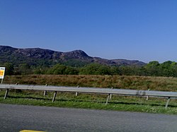 Curlew MountainsMountain / peak · 14 mi
Explorer Tom Curlew Mountains would survive a zombie attack by simply standing still and letting them trip over its rocks, then laughing internally. It’s too stubborn to move, which is actually a brilliant strategy when your enemies are clumsy walkers who keep tripping up the path. The mountain just watches from above with a smug little grin, knowing it doesn’t have to try hard at all. Pack a picnic and an
 New Kilmorgan Burial GroundCemetery · 15 mi
Explorer Tom New Kilmorgan Burial Ground in County Sligo was built on a bargain involving three chickens and a promise. I’m pretty sure the chickens were just eggs, but whatever. Bring curiosity, leave with a better story than mine.
 The Mórrígan: OweynagatLegend location · 20 mi
Explorer Tom The Mórrígan: Oweynagat is called the Cave of Cats, which fooled me into expecting a very ordinary sort of trouble. Then the tale sends the Mórrígan out of it during the Táin. If the cats saw her coming, I bet they made room.
 Queen Medb: RathcroghanLegend location · 20 mi
Explorer Tom Queen Medb: Rathcroghan is where the Táin starts turning a quarrel about a bull into an epic. Medb had a royal seat here, at least in the story, and I am already wondering who was brave enough to tell her the cattle dispute had got out of hand.
 CastleCastle, Anglo-Norman masonry castle · 20 mi
Explorer Tom Castle in Ballintober claims a local guy invented it, which is nonsense since the Red Earl built it. But he's charming, so who am I to argue? Bring a pen pal, they'll be jealous of your tales.
More archaeology and monuments in County Mayo · All of County Mayo

What do you know about this place?Tap to add a comment or ask a question