What is recorded here
Medieval church ruins (LI028-103002-) standing in centre of rectangular-shaped graveyard (approx. dims. 45m N-S x 70m E-W) located at S end of the village of Ardagh (LI028-103001-). Holy well (LI028-103004-) dedicated to St. Molua located 60m to SSW. St. Patrick's R.C. Church and modern car park located immediately to N. Small graveyard extension to S and SE. According to Bradley (1989, vol. 1, 49), 'It has been mentioned above that there is a possibility
that this was a pre-Norman church site. This suggestion is based on its dedication to Molua, the fact that the land belonged to the see of Limerick at the beginning of the thirteenth century, and the fact that the church gave its name to one of the deaneries of the medieval diocese'.
Medieval church ruins (LI028-103002-) standing in centre of rectangular-shaped graveyard (approx. dims. 45m N-S x 70m E-W) located at S end of the village of Ardagh (LI028-103001-). Holy well (LI028-103004-) dedicated to St. Molua located 60m to SSW. St. Patrick's R.C. Church and modern car park located immediately to N. Small graveyard extension to S and SE. According to Bradley (1989, vol. 1, 49), 'It has been…
From the National Monuments Service (Archaeological Survey of Ireland) record LI028-103003
The monument record does not grant public access. Check the route and ask the landowner before entering private land.
- What survives
- Recorded monument
Places near here
Photo credits
- National Inventory of Architectural Heritage
- Created by Kglavin Modified Aug 2007 by Mike Christie, Wikimedia Commons · CC BY-SA 3.0
- Mike Searle, Wikimedia Commons · CC BY-SA 2.0
- Willow, Wikimedia Commons · CC BY 2.5
- Mike Searle, Geograph · CC BY-SA 2.0
- A.-K. D., Wikimedia Commons · CC BY-SA 4.0
- Vadim Manuylov, Wikimedia Commons · CC BY-SA 3.0
St. Moluas WellHoly well · 105 yd Ardagh Railway StationRailway station · 267 ydbridge291 ydArdagh FortArchaeological place · 769 ydGlenville HouseCountry house · 1324 ydCathair MaothailHouse, steward's house · 1537 ydSt. Luke's WellSpring · 1.2 miTemplars Castle (in ruins)Castle, Anglo-Norman masonry castle · 3.1 miEuropean ash4.3 miCastle MatrixCastle · 4.6 miSaint Ite's WellSpring · 7.8 miMonterey Cypress8.6 mi
 Ardagh Railway StationRailway station · 267 yd
 bridge291 yd
 Ardagh FortArchaeological place · 769 yd
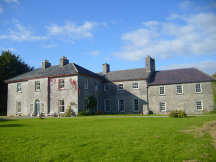 Glenville HouseCountry house · 1324 yd
 Cathair MaothailHouse, steward's house · 1537 ydSt. Luke's WellSpring · 1.2 mi
,_Newcastle_West,_Limerick_-_geograph.org.uk_-_1392672.jpg/250px-Castles_of_Munster,_Desmond_Hall_(Castle_Banqueting_Hall),_Newcastle_West,_Limerick_-_geograph.org.uk_-_1392672.jpg "Photo: Mike Searle, Wikimedia Commons · CC BY-SA 2.0") Templars Castle (in ruins)Castle, Anglo-Norman masonry castle · 3.1 mi
Templars Castle (in ruins)Castle, Anglo-Norman masonry castle · 3.1 mi European ash4.3 mi
 Castle MatrixCastle · 4.6 mi
 Saint Ite's WellSpring · 7.8 mi
 Monterey Cypress8.6 mi
More archaeology and monuments in County Limerick · All of County Limerick
What do you know about this place?